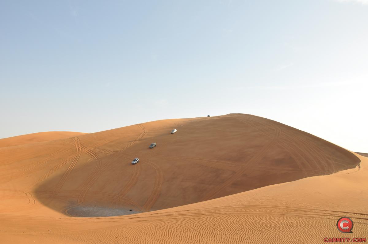
Jump to content
  •  

Gaia GPS For Beginners


Frederic

Recommended Posts

US$ 99 plan is with "Outside" subscription perhaps we dont need it. The normal rate for annual subscription is 39.99. I was able to renew mine just now for 34.99 (10% discount). I think it will automatically apply the coupon when you proceed to subscribe it.   

image.png.bb14a96892921d52cc336f0a6d63994d.png

  • Like (+1) 1

don't drive like its your last one.

Link to comment
Share on other sites

20 minutes ago, Looper said:

US$ 99 plan is with "Outside" subscription perhaps we dont need it. The normal rate for annual subscription is 39.99. I was able to renew mine just now for 34.99 (10% discount). I think it will automatically apply the coupon when you proceed to subscribe it.   

image.png.bb14a96892921d52cc336f0a6d63994d.png

Correct, no need for Outside+ subscription. 

  • Like (+1) 1

"Go as far as you can see; once you get there, you'll be able to see further."

Link to comment
Share on other sites

On 2/18/2022 at 11:02 AM, Frederic said:

image.png.2ab01ca0a1b9e50355991db948e7ff41.pngGaia GPS website shows 39.99USD for a yearly subscription.

Recently there was a promotion 19.99USD for 1 yr when you do that from normal web browser. I paid and got it , not sure if it ended or not.

  • Like (+1) 1
Link to comment
Share on other sites

  • 8 months later...

Gaia GPS is since a couple of years now a part of Outside Group.

I recently found out that for Premium members, you can upgrade to the Outside+ membership free of cost during the first year, and that you will automatically get access to lots of training tutorials.

image.png.b9bb59830ee709a1b996782c95371a44.png

NOTE: Renewal will be at 59,99USD per year instead of the regular 39.9 USD per year (Premium subscription).  I was able to click on "upgrade to Outside+" and it showed "0 USD", after confirming my credit card details i got immediate access to the entire Outside+ platform with below tutorials and courses:

image.png.a7b88d09c85896e7568525682b32b141.png


Mapping Archives | Outside Learn (outsideonline.com)


For anyone trying to get more out of his Gaia GPS functionalities i would highly recommend it.

  • Like (+1) 2
  • Thanks (+1) 3

"Go as far as you can see; once you get there, you'll be able to see further."

Link to comment
Share on other sites

And for the first-aiders in the club:

Wilderness First Aid Basics | Outside Learn (outsideonline.com)


  • Like (+1) 1

"Go as far as you can see; once you get there, you'll be able to see further."

Link to comment
Share on other sites

  • 2 weeks later...
On 9/10/2020 at 2:00 PM, Frederic said:

For many offroaders, navigation looks like a scary thing, and finding your way in the desert used to be a daunting task with old obsolete maps, navigation with sun or stars, and many other old tricks of crossing the deserts.

Until 5-6 years ago, companies like TomTom and Garmin were ruling the navigation software and hardware, until our phones became smarter and smarter, and nowadays there are tons of free or paid navigation software programs available which are tailored for hiking, offroading, cycling, or other outdoor activities where you would like to record your tracks. 

In this post i will give some basic essential advice on how to get started with navigating by using GaiaGPS, which is an amazing app that allows you to:

1) Create routes at home via your desktop/tablet through the GaiaGPS website.

2) Use different types of maps like topographic maps, sattelite maps, to find your perfect route you'd like to explore.

3) Save and manage all your tracks, waypoints, areas.

4) Automatically sync all this data with the GaiaGPS Mobile App that is being used to record your track or follow the route you have created beforehand.

1) Registering for GaiaGPS account

https://www.gaiagps.com/membership/

You can choose for a FREE account, which works fine for basic topographic and sattelite maps, but will not allow to use them offline.

The PREMIUM membership is recommended for around 3.3 USD per month.

Once you have become a member, you can head over to Gaiagps.com, login with your account name, and have a look at the basic functionalities. I've posted a short video below that gives a small demo on how to use the GaiaGPS website functionalities.

As you can see in the screen, there are many tracks i've recorded with my phone that remain saved in the website. You can remove these, or hide them. The red zones i have marked are called "areas" where you can identify tricky areas that you would like to avoid. They will appear on your phone app as well so you can easily avoid them.

Waypoints

Waypoint, or pins, could be points of interest, landmarks, entry and exit points, or any place where you want to mark the location and save for later reference. They will appear as a "pin" on your map. You can assign a color to them as you like. This might be useful as you can categorize them. Next to the classic PIN icon, you can choose different other ones, like fences, skulls, forest, or anything that will help you in identifying the waypoint.

image.png.fc753d6c1477bb6dcf897f1bfef6e523.png

Sattelite Images

Having crisp detail in the sattelite images you are looking, is essential so you can create a route which focuses on the nice bigger dunes instead of the small technical or bushy areas. Gaia comes standard with the Mapbox "Sattelite with Labels" Imagery which is not bad, but the best one i have found so far is the ESRI Sattelite Imagery Map. Below you will find some information on how to add custom maps.  The map called "WORLD IMAGERY" in the Premium version is the same as the ESRI Sattelite Imagery Map.

Which phone ?

Gaia GPS will work on any smartphone that has a decent GPS antenna built-in. In my case i purchased a separate dedicated Android phone which is mounted in my car that i solely use for navigation. This allows me to keep using my own phone as backup device. That dedicated phone has the offline maps downloaded on it, so i do not need cellphone coverage (no sim card). 

App functionality

On an Iphone, this is how the app looks like.  The buttons like "RECORD" and "PICTURE" are customizable, and by keeping your finger on it you can select something else you would like to see on the home page. 

image.png.2e667d96f609b868106e8596b4c9bd22.pngThe Magnifying Glass allows you to enter coordinates. You can copy them from within Google Maps.

image.png.957badab1e10009f37346d919982342a.png this button toggles between full screen or normal screen.

 image.png.c029c9fe64cc4d0f1e25aa7f26e39f52.png The crosshair button is very important. Click on it once and it will appear green and bring you to your live location and follow you while keeping NORTH up. Click on it again and another logo appears, looking like two reversed triangles. This is the mode that keeps your live location but constantly rotates the map based on your direction. You can experiment with both modes to see what suits you best. I like to stick to the first mode because it allows me to see in which compass direction i am heading.

image.png.794d4a87d21cfe243c9b0d114017d534.png The + Button contains all your other useful functionalities, like adding a waypoint, creating a route, download an offline map, or create an area.

image.png.5eb7eba6b1a35e2e886393863fab9d66.pngOnce you hit the record button, the app will start recording your track. Once you finish, click again on it and select "Finish Track" It will then be saved. (and also appear on your GaiaGPS website once you have synced).


IMG_9344.PNG.ac7b62bf6ad4ca9089d5d48625962d2c.PNG

On the bottom, you can see your trip details, open the list of saved tracks, or go to your settings. 

Note: In the settings you can put your units/distances in miles or kilometers (whatever you prefer). You can also enable or disable the autosync function, but better to keep it on. So as soon as you have Wifi/Internet on your phone it will automatically sync your tracks between the app and your GaiaGPS account (website).

These things will take a bit of practice, and i can recommend you to use your Gaia mobile app for a while on your daily commute, and experiment a bit with the settings until you have tailored it to your own needs.

Exporting Maps

Most navigation software use .gpx or .kml files which you can import in Google Earth / Maps or any other navigation program. On the GaiaGPS website, and also on the app you can choose to "export" your track. It will create a .GPX file that you can share with fellow offroaders or import in the Relive app :) 

Adding Custom Maps 

for the GaiaGps app users, the Google Maps like Satellite, Terrain, or Hybrid, are not standard built in, but can easily be added by using the GaiaGps website.

This is the procedure to add for example Google Terrain.

1) While logged into Gaiagps.com, add a custom map source via TMS here: https://www.gaiagps.com/mapsource/add/

2) Fill in this TMS URL to get Google Terrain: https://mt0.google.com/vt/lyrs=p&hl=en&x={x}&y={y}&z={z}&s=Ga 

3) Give it the name "Google Terrain" 

4) Set the Min and Max Zoom level on 4 and 19.

5) Click on "Add this Map Source"


The next time you will login it will appear in your mobile app.

Some other map links. To add them, follow the same steps as above:

Google Maps: https://mt1.google.com/vt/lyrs=r&x={x}&y={y}&z={z}
Google Satellite:https://www.google.cn/maps/vt?lyrs=s@189&gl=cn&x={x}&y={y}&z={z}
Google Satellite Hybrid:https://mt1.google.com/vt/lyrs=y&x={x}&y={y}&z={z}
Google Terrain:https://mt1.google.com/vt/lyrs=t&x={x}&y={y}&z={z}
Google Roads:https://mt1.google.com/vt/lyrs=h&x={x}&y={y}&z={z}
ESRI Sattelite Imagery:https://server.arcgisonline.com/ArcGIS/rest/services/World_Imagery/MapServer/tile/{z}/{y}/{x}


Great Stuff @Frederic!!! I think this will take my drives to a completely another level! Many many thanks

  • Like (+1) 1
  • Thanks (+1) 1
Link to comment
Share on other sites

  • 5 weeks later...

Recently Gaia has been a regular topic of discussion, as I started to do partial leads. During these discussions, an issue that came up regularly is how the tracks become unmanageable and do not make any sense anymore, leading to users deleting their old tracks. I too found the same issue while I was still new, perhaps 10 to 15 drives old, and I was intermediate already! When I was driving in the same area there were multiple tracks in different colours, and nothing made sense. Since Fewbie level I have been organizing my recorded tracks and I want to share my housekeeping tricks in post in the hope that a few of you might find it helpful.

1.       Start Early: If you start early to organise your drives and with a little bit of housekeeping from the start you can better manage the tracks in the future, and it does not become a big headache later. Even if you are not subscribed to the app, do record the tracks even with the free version and keep them.

2.       Folders: Create folders for each level of drive, such as Newbie, Fewbie and so on. I have folders for other types of drives, e.g., drives with friends, wadi drives etc. After each drive while saving the track, immediately put the track in those folders while saving the track.

Gaia also gives an option to add photos you took during the drive to attached as well. While I do it, I delete them (Profile>Photos) later as it leaves a bunch of waypoints that I don’t need. The photos seem to stay with the track even after deleting them.

Saving tracks in folders makes it quite easy to hide/unhide (eye button in saved tab) a bunch of tracks at the same time. These days I hide all the tracks and keep the current plan visible. Any new drive you record will automatically be visible till you hide them.

3.       Colour Coding: You can colour code all drives in a level with one colour. In my case I used the same colours that were used in my stats posts.

I considered either colour coding or creating folders by Lead or Area instead of filing tracks by Level + color-coding them at the same time, because it seemed like duplication. But those options either did not add any value to me or the process made it more confusing for me. Your experience might vary.

4.       Rename Tracks: Rename the track with the area you did the drive and the lead with who you drove in the title. I also put the participants' names in the notes section. This helps you find specific tracks by searching for them (use “Download guest list” in calendar to get text of all names).

As a newbie lead, I go back to my most memorable drives from the past in an area to plan for the next drive. Some time I get to see a great track to drive and other times I take the convoy though a technical jungle; either way it is fun.

  • Like (+1) 6

don't drive like its your last one.

Link to comment
Share on other sites

6 hours ago, Looper said:

Recently Gaia has been a regular topic of discussion, as I started to do partial leads. During these discussions, an issue that came up regularly is how the tracks become unmanageable and do not make any sense anymore, leading to users deleting their old tracks. I too found the same issue while I was still new, perhaps 10 to 15 drives old, and I was intermediate already! When I was driving in the same area there were multiple tracks in different colours, and nothing made sense. Since Fewbie level I have been organizing my recorded tracks and I want to share my housekeeping tricks in post in the hope that a few of you might find it helpful.

1.       Start Early: If you start early to organise your drives and with a little bit of housekeeping from the start you can better manage the tracks in the future, and it does not become a big headache later. Even if you are not subscribed to the app, do record the tracks even with the free version and keep them.

2.       Folders: Create folders for each level of drive, such as Newbie, Fewbie and so on. I have folders for other types of drives, e.g., drives with friends, wadi drives etc. After each drive while saving the track, immediately put the track in those folders while saving the track.

Gaia also gives an option to add photos you took during the drive to attached as well. While I do it, I delete them (Profile>Photos) later as it leaves a bunch of waypoints that I don’t need. The photos seem to stay with the track even after deleting them.

Saving tracks in folders makes it quite easy to hide/unhide (eye button in saved tab) a bunch of tracks at the same time. These days I hide all the tracks and keep the current plan visible. Any new drive you record will automatically be visible till you hide them.

3.       Colour Coding: You can colour code all drives in a level with one colour. In my case I used the same colours that were used in my stats posts.

I considered either colour coding or creating folders by Lead or Area instead of filing tracks by Level + color-coding them at the same time, because it seemed like duplication. But those options either did not add any value to me or the process made it more confusing for me. Your experience might vary.

4.       Rename Tracks: Rename the track with the area you did the drive and the lead with who you drove in the title. I also put the participants' names in the notes section. This helps you find specific tracks by searching for them (use “Download guest list” in calendar to get text of all names).

As a newbie lead, I go back to my most memorable drives from the past in an area to plan for the next drive. Some time I get to see a great track to drive and other times I take the convoy though a technical jungle; either way it is fun.

Great topic @Looper and i knew when i took up this issue with you that you were gonna be prepared :) 

I find the folder structure GaiaGPS uses a bit awkward and many hardcore GaiaGPS users are now stepping over to Caltopo, which i've been testing for a while now and really impressed by their web browser are route planning, but the mobile version is not yet up to the mark in my opinion.

Anyways, what i do is make a folder for each emirate, and then put my tracks in that folder based on where i've driven. That way i can export for example that entire folder (Dubai by example) into one single .gpx file (including all the waypoints associated with that).

This method works well in Gaia, but whenever i import a track someone else had sent me, it creates its own folder, which i do not want, and have to move this folder into the folder of the right emirate.

Colour coding of tracks is a good idea. I do not use any colour coding on my tracks, but i do for my waypoints:

1. Red waypoints are entry and exit points.

2. Yellow waypoints are landmarks.

3. Purple waypoints are bowls and play areas

I also recommend to keep the "best" version of a certain area you have done, and delete or archive/hide all the rest. If not, within 1 year your Gaiagps app will look like a spiderweb and will become extremely frustrating to use while leading.

Naming is also important. I use the following example:

SHJ-Badayer-FB-FNU

(Sharjah Emirate, Badayer Area,Fewbie Level,my name code)

That way, if you use the alphabetic filter in Gaia, all your tracks from SHJ will be all nicely lined up.


  • Like (+1) 6
  • Totally Agree (+2) 1
  • Well Done (+2) 1

"Go as far as you can see; once you get there, you'll be able to see further."

Link to comment
Share on other sites

59 minutes ago, Frederic said:

Great topic @Looper and i knew when i took up this issue with you that you were gonna be prepared :) 

I find the folder structure GaiaGPS uses a bit awkward and many hardcore GaiaGPS users are now stepping over to Caltopo, which i've been testing for a while now and really impressed by their web browser are route planning, but the mobile version is not yet up to the mark in my opinion.

Anyways, what i do is make a folder for each emirate, and then put my tracks in that folder based on where i've driven. That way i can export for example that entire folder (Dubai by example) into one single .gpx file (including all the waypoints associated with that).

This method works well in Gaia, but whenever i import a track someone else had sent me, it creates its own folder, which i do not want, and have to move this folder into the folder of the right emirate.

Colour coding of tracks is a good idea. I do not use any colour coding on my tracks, but i do for my waypoints:

1. Red waypoints are entry and exit points.

2. Yellow waypoints are landmarks.

3. Purple waypoints are bowls and play areas

I also recommend to keep the "best" version of a certain area you have done, and delete or archive/hide all the rest. If not, within 1 year your Gaiagps app will look like a spiderweb and will become extremely frustrating to use while leading.

Naming is also important. I use the following example:

SHJ-Badayer-FB-FNU

(Sharjah Emirate, Badayer Area,Fewbie Level,my name code)

That way, if you use the alphabetic filter in Gaia, all your tracks from SHJ will be all nicely lined up.


Thanks @Frederic and @Looper I have fallen victim to just recording drives without any organization or file name structure. and to think that I'm 'tech' orientated! 


planning to take an evening I'm not studying to siphon through all the recorded path's potentially just archive them to revisit whenever I happen to adventure out and start all over again, but this time actually using Gaia's user interface 😄


ps. I really like the idea of marking the entry and exit points, and naming them via level of drive-in combination with folders.  

  • Like (+1) 2
Link to comment
Share on other sites

We all have our own ways of organizing stuff, and something that works best for one might not work for another.

As a compulsive data hoarder and list maker, I will never be able to bring myself to keep few tracks to delete others, I am OCD-d to keep everything and try to manage. Also, for the first 165 drives technically I never had any reason to go back and see where I was driving since all that I needed to do was to follow the lead. So, I would just move the file to the designated folder and hide them, not a single track on the Gaia!

On the other hand, as seasoned off-roaders with way more experience than most of us reading a post about "Gaia GPS for Beginners"; we have a lot to learn from you. @Frederic!

  • Like (+1) 1

don't drive like its your last one.

Link to comment
Share on other sites


×
×
  • Create New...

Important Information

Terms of use