-
5.0 Stars ⭐⭐⭐⭐⭐ 628 Google Reviews

Looper
-
Posts
5,175 -
Joined
-
Last visited
-
Days Won
98 -
Country
India -
Carnity Points
66 [ Donate ]
Content Type
Profiles
Forums
Advice
Business Listing
Car Deals
Recall
OBD II Car Diagnostics
Guest lead capture
STORE
Events
Gallery
Blogs
Everything posted by Looper
-

956460315_20230909HiResEdit.jpg
Looper posted a gallery image in Fewbie Plus - Nahel - Al Ain- Abu Dhabi - 09 Sep 2023
-
Imran Asghar has been promoted to Support Team
Looper replied to Gaurav's topic in Off-Road Club's Announcements
Congratulations @Imran Asghar, welcome to Team Carnity!! -
Sunil Mathew has been promoted to Support Team
Looper replied to Gaurav's topic in Off-Road Club's Announcements
Congratulations @Sunil Mathew on your promotion, welcome to Team Carnity. -
Team Looper with @Bravoecho, @Stumpy Paj, @Bashar Beasha and @Mahmoud Taha was the first to complete and the invitation closed. Thank you all for joining. We have already kickstarted our preparations starting with a preparatory drive this Sunday. Inshallah we will do great in DCT, all the best to us.
-
Section 3: Data Acquisition for Telemetry Overlay Introduction to Telemetry Overlay Telemetry is the in-situ collection of measurement of various data points such as speed, elevation, G force, track etc. In our sport we use Global Positioning Satellite or GPS to collect this information. Most of us record the track in apps such as Gaia GPS. While driving we feel the adrenaline but by the time we look the same drive footage, it does not look that impressive. This is where in my opinion the Telemetry Data overlay plays an important role as it helps to highlight the rollercoaster ride that we experience. I like to overlay the Track, Speed, Speed Profile and Elevation profile along with the Compass to give an immersive experience of the drive. Integration with Insta 360 X3 We can record the GPS data embedded with the footage we record while driving. This can be achieved in two ways. In Insta360 X3 camera, if GPS remote is used to record video, it also records the GPS data by default. In case a phone is used as a remote, in that case the user can enable GPS data recording as well. However, in my experience the data collected using phone as a remote is quite unreliable and gives erroneous information. GoPro Max, however, records the GPS data by default in the device itself and it does not need external sources to get the data. Another way to overlay telemetry data is using external independent data sources such as Gaia GPS. However, it becomes cumbersome to sync data with the footage to overlay on the video data source. An issue with GPS data is, however, good the data source might be, it still sometimes looks different than the footage. Because the data is collected using satellites and there is always a time delay. This is more pronounced while looking at Speed data, while a vehicle would have come to a stop in the footage, but the data recording will show gradual decrease in the speed to zero. Another issue is if you are using maps to show the track, it might not correlate to the actual footage, due to the shifting dunes as well. In this video I recorded at Faya (see the previous post) I have overlayed a mini map showing the track, and speed and direction. You will see that the dunes on the map don't match all the time with the footage. In the following video I recorded at Badayer I have overlayed the speed provided as well as elevation profile. These two are normally an approximation rather than cent percent accurate data. PS: I plan to update and revise certain sections to enhance clarity, streamline information for brevity, and improve language and grammar.
- 13 replies
-
- 4
-

-

-
- insta360
- video editing
- (and 2 more)
-
Agree, one can enjoy every type of terrain, we had long stretches of radio silence which was in a way quite relaxing - just driving and not doing much, unfortunately there was not much to do as well. was there a typo in your post I your previous post ? I was responding to you saying it was NOT nice to drive in different types of terrain.
-
I could totally disregard the second part for next time. The first part was quite good though, no?
-
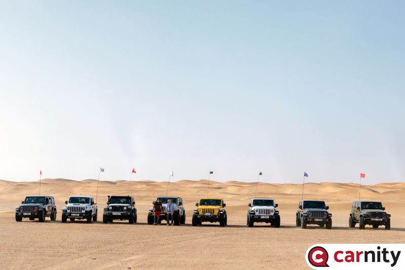
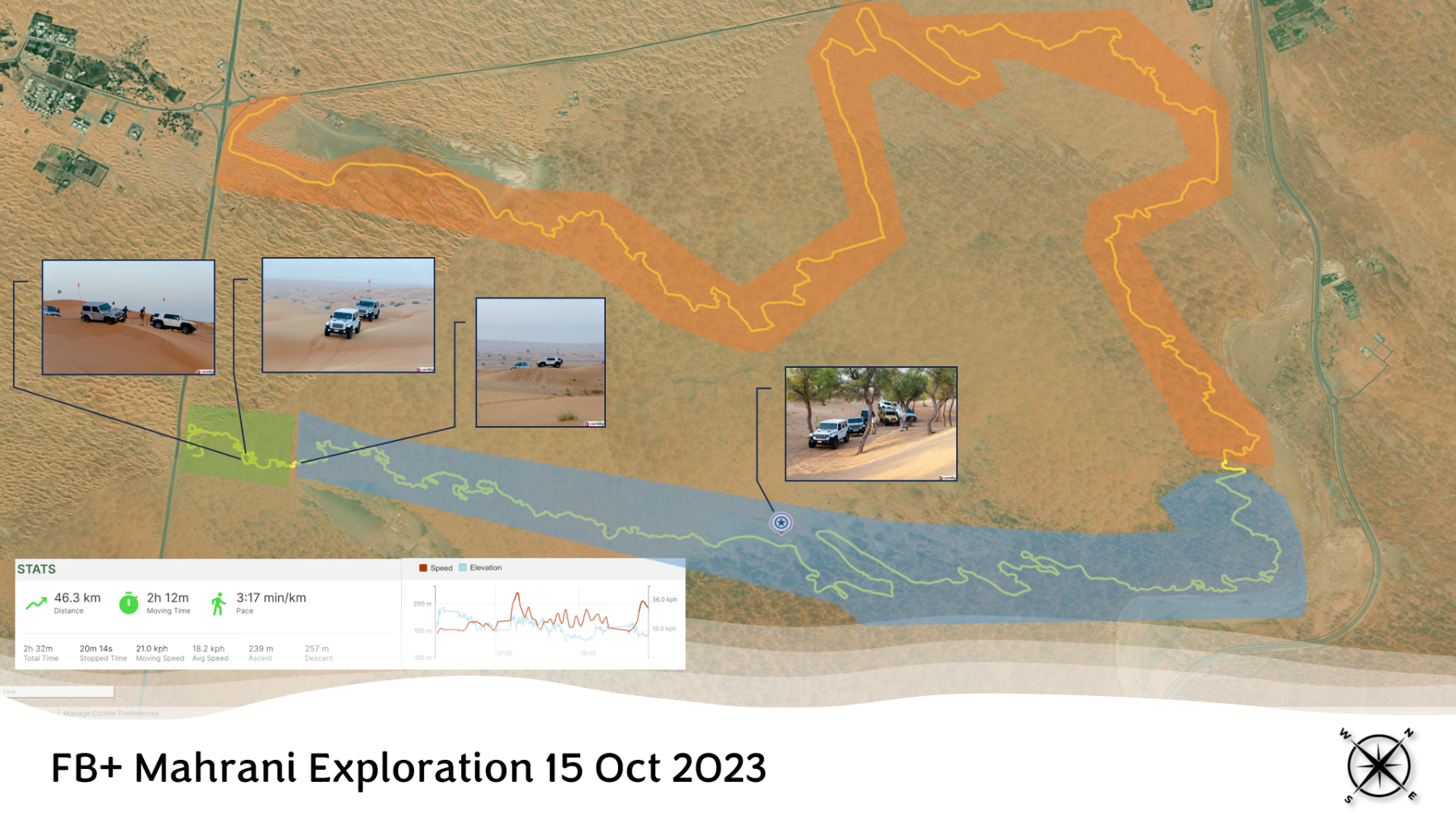
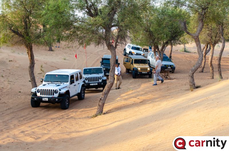
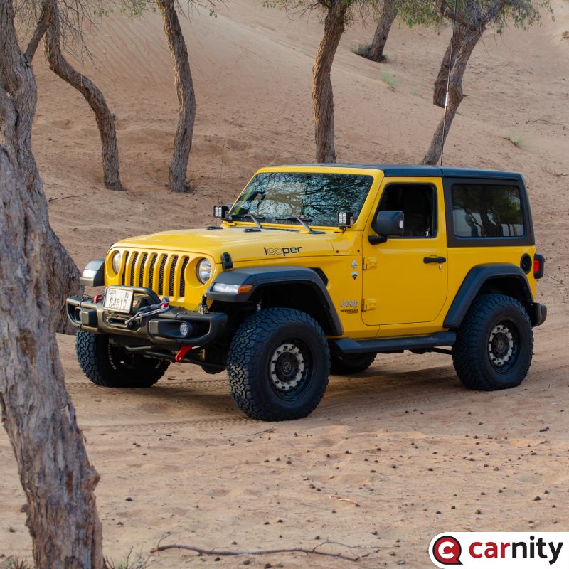
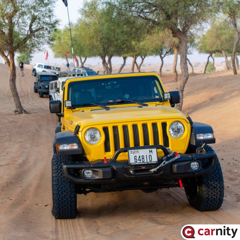
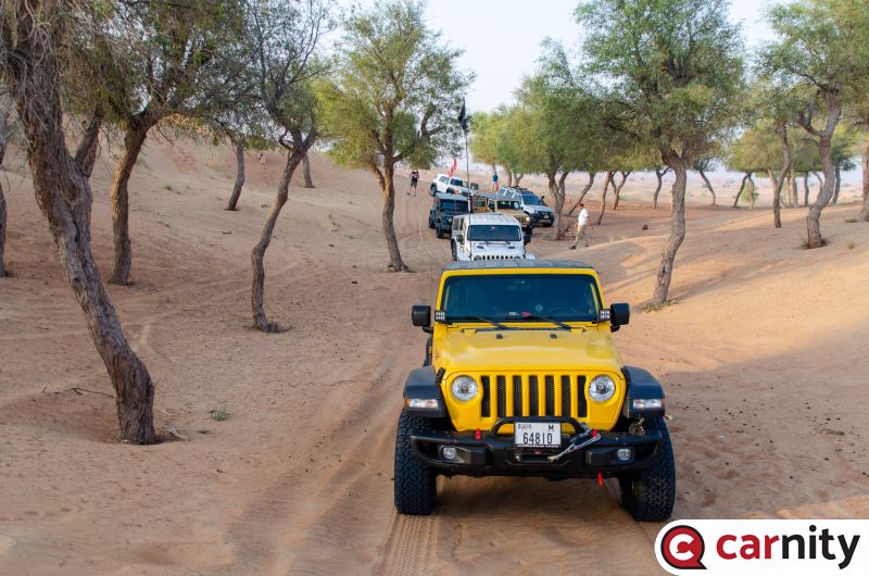
Drive Report It was a mixed bag of a drive. The drive as an exploration came true in its character and it was a bouquet of many surprises. The driving character took many twists and turns and surprised us all, not necessarily in all good throughout the drive. The beginning (green area): It was the only section that had the features of a Fewbie+ drive. The dunes were tall and soft. I wanted sooo... much to play in that area but because I knew we had a long drive ahead of us i kept moving from there. In hindsight we should have played there more. In this area we had a couple of refusals, one where we had to tug and the other where we could self-recover easily. The Mid (blue area): this section was giving the old Mahafiz vibes though out the section. At the begining we moved swiftly with many twists and turns, driving like stokes of brush on a canvas. We took a break at the jungle made of roughly 50 trees. It was the first time i was there and loved the area plus the temps were still under 30s, so it was a pleasant stoppage. Then we passed though some very tall dunes on one side and steep descent and sabkha on the other. This one was a Fewbie level track that I would love to revisit. I am sure a FB convoy will love this area. The end (yellow area): then began the quest to find some sand and a constant drive though all the trails. We kept driving though this area trying to find some sand, any sand but kept finding only bushes. It bore marks of a glorious past with the off roaders but as most deserts in UAE, it bloomed with evergreen vegetation. Greenery is the default state of the deserts, something that anyone can expect. I would totally avoid this area as an unnecessary venture into pasturelands. While I wanted to bring the convoy back to where we started, we ended early not wasting time anymore. Thank you all for participating in this drive, @Juan R, @Deepak Eswar, @Andrei S, @Anoop Nair, @Mahmoud Taha, @Jaro Tuzinsky
-
No Unfortunately it won't. It will appear in the others section on your drives list.
-
BTW we will do some photography as well for the Team Looper Logo artwork.
-
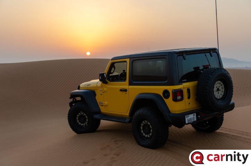
20231015-021.jpg
Looper posted a gallery image in Fewbie Plus - Mahrani Loop - Sharjah - 15 Oct 2023
-
20231015-020.jpg
Looper posted a gallery image in Fewbie Plus - Mahrani Loop - Sharjah - 15 Oct 2023
-
20231015-019.jpg
Looper posted a gallery image in Fewbie Plus - Mahrani Loop - Sharjah - 15 Oct 2023
-
20231015-018.jpg
Looper posted a gallery image in Fewbie Plus - Mahrani Loop - Sharjah - 15 Oct 2023

-
20231015-017.jpg
Looper posted a gallery image in Fewbie Plus - Mahrani Loop - Sharjah - 15 Oct 2023
-
20231015-016.jpg
Looper posted a gallery image in Fewbie Plus - Mahrani Loop - Sharjah - 15 Oct 2023
-
20231015-015.jpg
Looper posted a gallery image in Fewbie Plus - Mahrani Loop - Sharjah - 15 Oct 2023
-
20231015-014.jpg
Looper posted a gallery image in Fewbie Plus - Mahrani Loop - Sharjah - 15 Oct 2023
-
20231015-013.jpg
Looper posted a gallery image in Fewbie Plus - Mahrani Loop - Sharjah - 15 Oct 2023
-
20231015-012.jpg
Looper posted a gallery image in Fewbie Plus - Mahrani Loop - Sharjah - 15 Oct 2023
-
20231015-011.jpg
Looper posted a gallery image in Fewbie Plus - Mahrani Loop - Sharjah - 15 Oct 2023
-
20231015-010.jpg
Looper posted a gallery image in Fewbie Plus - Mahrani Loop - Sharjah - 15 Oct 2023
-
20231015-009.jpg
Looper posted a gallery image in Fewbie Plus - Mahrani Loop - Sharjah - 15 Oct 2023
-
20231015-008.jpg
Looper posted a gallery image in Fewbie Plus - Mahrani Loop - Sharjah - 15 Oct 2023
-
20231015-007.jpg
Looper posted a gallery image in Fewbie Plus - Mahrani Loop - Sharjah - 15 Oct 2023