-
5.0 Stars ⭐⭐⭐⭐⭐ 628 Google Reviews

Looper
-
Posts
5,173 -
Joined
-
Last visited
-
Days Won
98 -
Country
India -
Carnity Points
64 [ Donate ]
Content Type
Profiles
Forums
Advice
Business Listing
Car Deals
Recall
OBD II Car Diagnostics
Guest lead capture
STORE
Events
Gallery
Blogs
Everything posted by Looper
-
 untilDRIVE DETAILS Level: Fewbie Plus and above When: 28 April 2023, Sunday Meeting time: 6:30 AM - Sharp Meeting Point: https://maps.app.goo.gl/MBRWvN3aDSSsaHRb7 (24.733092, 55.565264) Approximate finish time: 10:30 AM approx. Type of Car: Any proper 4x4 with front and back tow hooks and 8-10 inches of ground clearance. What to bring along: Loads of water, snacks (for yourself), smiles, enthusiasm, and willingness to learn.
 -
Thank you all for joining the drive. I hope you all are doing well. Due to the unprecedented rainfall during the week which was highest in 75 years and was worth 2 years of rainfall; we have decided to cancel all drives for this week. We will post new drive on Monday and you may join them again. I did a drive at 2nd December few days ago after a very heavy rain fall and had a lot of fun, but this is different. Compared to this event the previous rainfall was like watering a garden. Out of abundance of caution we are going to cancel this week’s drive and try our luck next week. Stay safe.
-
Shaun J has been promoted to Fewbie Plus level
Looper replied to Gaurav's topic in Off-Road Club's Announcements
Congratulations @Shaun J to FB+. Well done. -
Mahmut has been promoted to Fewbie Plus level
Looper replied to Gaurav's topic in Off-Road Club's Announcements
Congratulations @Mahmut on your promotion to FB+. Enjoy your new level. -
Batuhan Kulac has been promoted to Intermediate level
Looper replied to Gaurav's topic in Off-Road Club's Announcements
Congratulations @Batuhan Kulac, welcome to your new level. Enjoy! -
Aser has been promoted to Fewbie Plus level
Looper replied to Gaurav's topic in Off-Road Club's Announcements
Congratulations @Aser, well done! -
RiadJL has been promoted to Fewbie level
Looper replied to Gaurav's topic in Off-Road Club's Announcements
Congratulations @RiadJL on your promotion ! -
Carnity's Spectacular Off-Road Adventure Videos
Looper replied to Looper's topic in General Discussions
Premiers at 7:00 p.m. Monday 15th April 2024. Insta 360 Studio has released a new version 5 of their Insta360 Studio App. In this app they have added a Project feature where you can add many clips and frame and stitch them together. So I have changed the work flow a bit. This is the first video, where I have used Insta360 Studio to reframe and stitch multiple clips. However I did the post in the FCPX, where I added titles. The aspect ratio of the video is in 1:2.35 which is considered 70mm or cinematic. I did not add any telemetry or music to this video. My videos are best enjoyed on a Television. I hope you enjoy the video. Please do subscribe to the channel to support what I do. -
DRIVE PLAN This would be the place where I did my first Fewbie Plus drive and a great place to drive. After we are finished with the drive in the Nahel Area we will take track to head towards Sweihan and finish there. The drive will have approximately 2:00~230 hours of drive time and half hour of breaks. GENERAL OVERVIEW We request every member that joins this drive to go through the information below and strictly follow these guidelines, etiquette and responsibilities. MUST READ AND COMPLY Environmental Policy Offroad Flag Guideline Two Way Radio Guideline Off road Driving Etiquettes Emergency details for all off roaders Off Road Driving - Roles & Responsibilities DRIVE DETAILS Level: Fewbie Plus and above When: 20 April 2023, Saturday Meeting time: 6:30 AM - Sharp (we will start the drive at 6:30) Meeting Point: 🫥 Approximate finish time: 9:30 AM approx. Type of Car: Any proper 4x4 with front and back tow hooks and 8-10 inches of ground clearance. What to bring along: Loads of water, snacks (for yourself), smiles, enthusiasm, and willingness to learn. RECOMENDED OFF-ROAD GEAR: Tire deflator & Tire pressure gauge Compressor (MANDATORY) Walkie-talkie radio (MANDATORY) Off-road flag (MANDATORY) Shovel, Tow Rope & 2 Shackles First-aid kit Fire extinguisher. LIMITED SPOTS AVAILABLE This drive is limited to 10 cars only. If the RSVP is full, you can add your name to the waitlist, once anyone drops, you will be moved to the RSVP list. RSVP will close a day prior to preparing a convoy list. Latecomers will be returned - Without any exceptions. Members without RSVP will be returned - Without any exceptions. Please withdraw your RSVP, if you aren't joining, so your spot can be taken by others. Repeated no-show members after RSVP will have their account suspended for a month. PLEASE RSVP ON THE CALENDAR

-
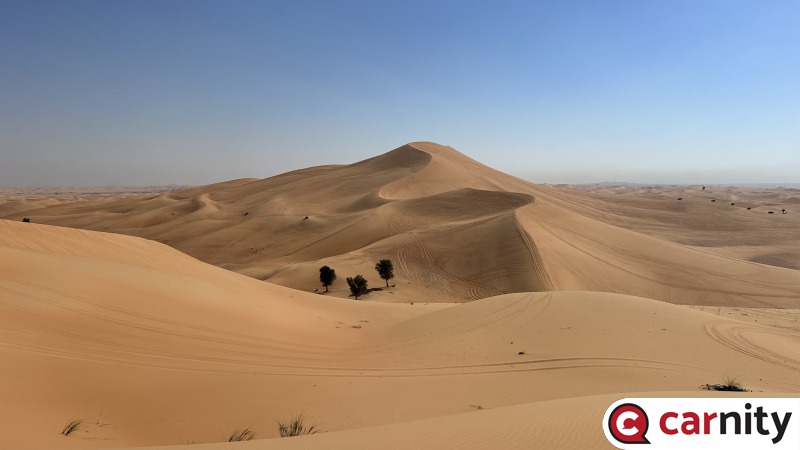
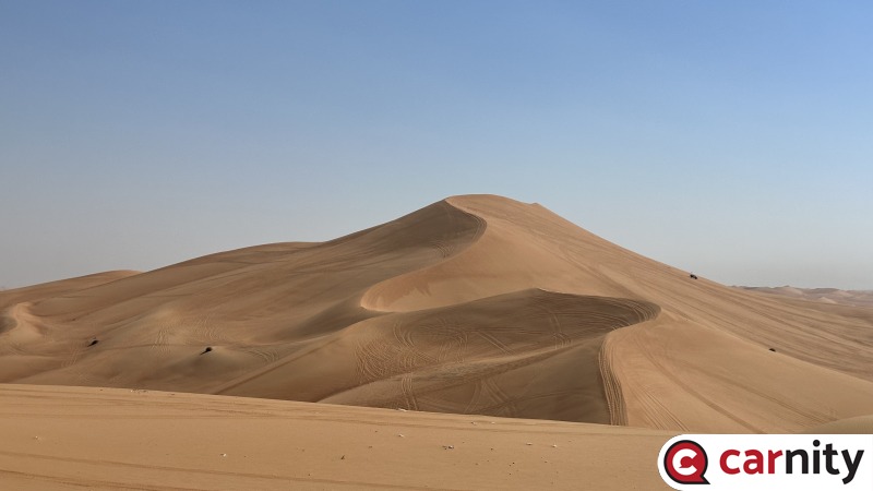
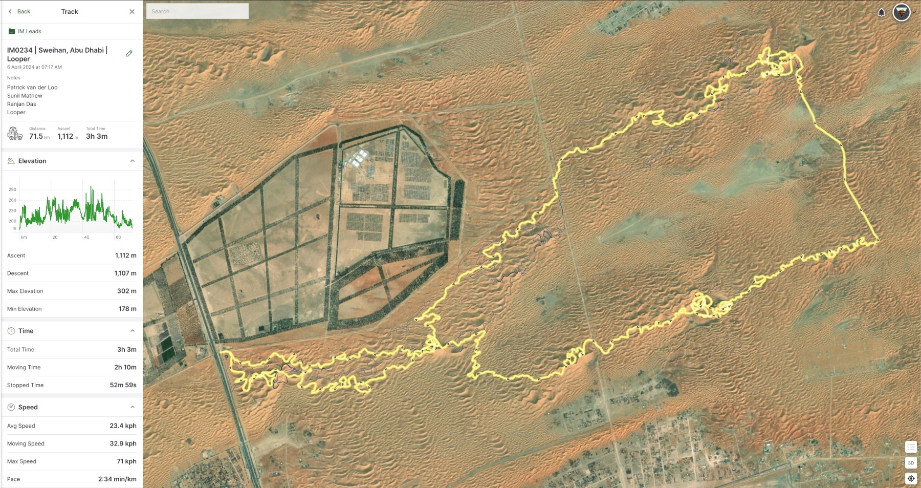
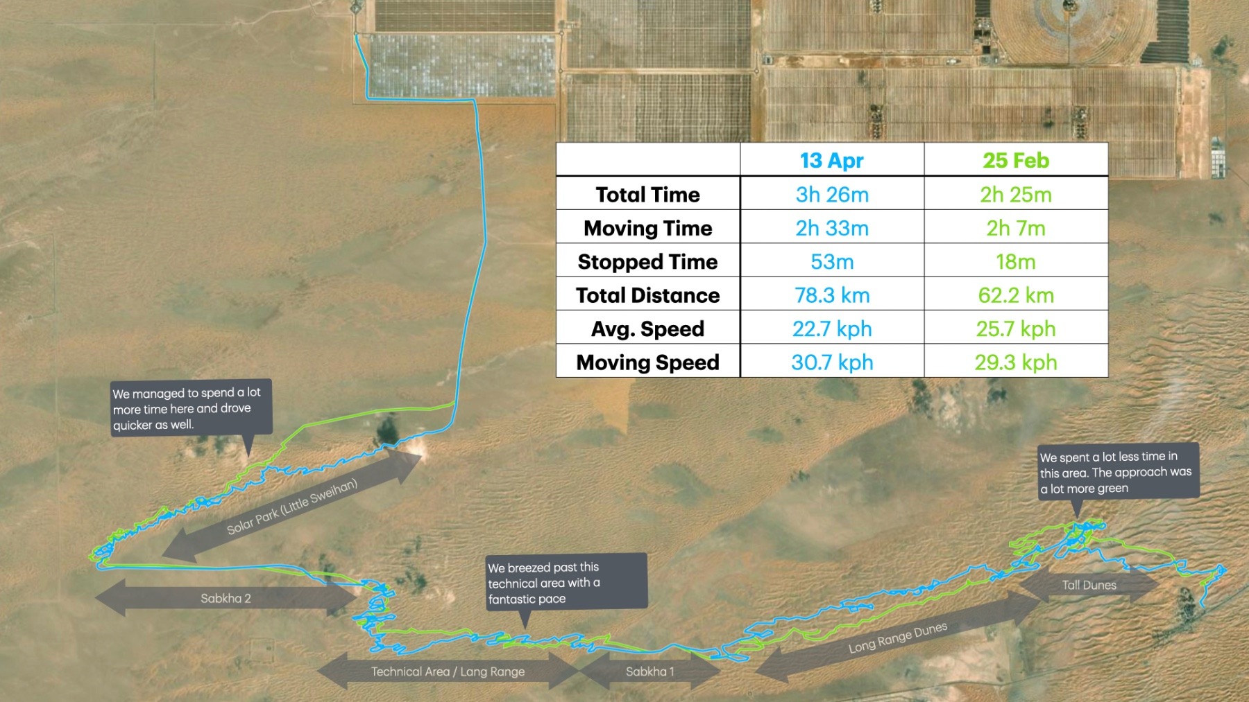
The statistics speak of themselves what a drive we had. We could explore a less frequently driven areas, see a fox in the desert; and have a fast exit just like last time. We had @Sunil Mathew who joined on this repeat of the drive from last time. @Ranjan Das and @Patrick van der Loo replaceing Pacific and Gertjan. Otherwise the composition of the drive was pretty similar - go to Nagra Hill - express hate on churned up tracks there and head back. Having said that the general pace was much better, we were able to find a lot more cleaner desert and obviously tried to have a lot more fun. more than the drive, I enjoyed our breaks and small talk. This is one of drives where we stopped to talk and not due to refusals. See you soon once again.
-
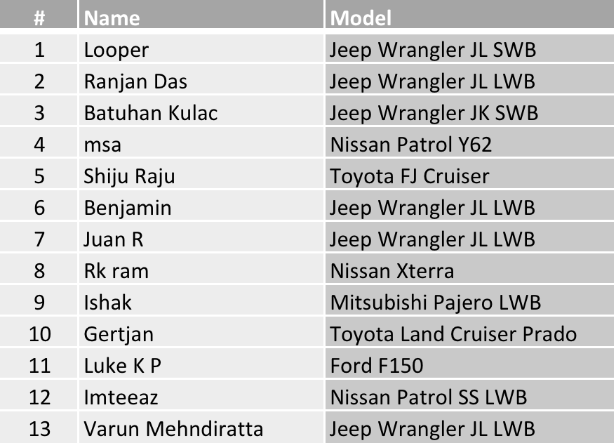
I travelled back to Dubai and landed at mid night and barely had 3 hours of sleep. But the love for dunes pulls me towards deserts. The initial section was a bit underwhelming for me, I wont lie - doing the same thing again in such a short time - I guess the wow factor was going to be missing a bit, but I think we more than compensated with a run across the dunes thereafter. Even during the technical patches between the Sabkhas we kept a fantastic pace. It was great to see so many of you showing up for the second instalment hope you enjoyed it as much as I did. The sand however was very bright in the eyes and I wasn't able to figure out the terrain much, even dark glasses did not help - yet the drive was lot less bumpy than previous. Thanks @Varun Mehndiratta for being part of the drive, your presence gave me peace of mind that even if I fail to join this drive - you would have taken over. @Ranjan Das & @Imteeaz thanks you both of you Support Team members for your help and well support. @Batuhan Kulac, @Ishak and @Luke K P see you once again for the drive. @Juan R see you once again after a long while. @Benjamin sorry to miss you. Been there done that, hope you have already fixed the issue. @msa, @Gertjan & @Shiju Raju hope to see you guys next time.
-
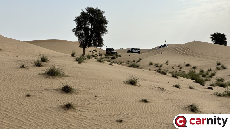
My third time doing this drive and I still haven't have enough of it. This is the only place left in Qudra to drive and I like to post my second drives of the week here for a quick spin in the dunes. We did a lot more technical and a bit difficult one at that, as the convoy kept up to the challenge, I kept pushing. The key to driving here is to keeping focus and keeping your eyes and ears open to what happening in front. I must say that everyone did a great job. Unlike last time towards the end the side slopping areas were not that enticing anymore as green pastures keep encroaching into the desert. A BIG thanks to @Rob S for answering my plea for support and joining the drive irrespective of his other prior commitments. Considering that the drive was borderline Fewbie Plus @Andrew John Melvill & @Shaun J you did a great job. @Marek you were fantastic behind me at second lead. @Ishak you obviously know this area well and I must say to @Luke K P that I am guilty as charged in a short wheel based Jeep that can practically do 360 degree turns standing still - you did well to manage the terrain. Thank you all once again for joining the drive and see you soon once more.
-
FA695478-3D97-48C0-9D52-9D13128CEC93.jpeg
Looper commented on Looper's gallery image in Fewbie Plus - Faqa'a Done Right (2nd Edition) - Abu Dhabi - 13 Apr 2024
 Thanks @Ranjan Das
 -
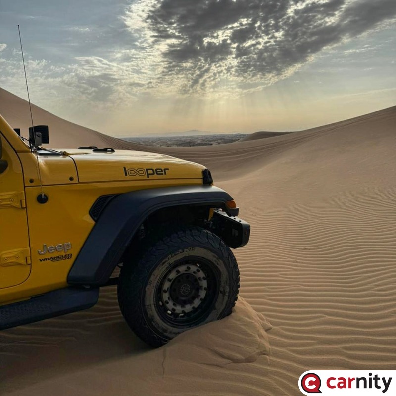
IMG_2957.jpeg
Looper posted a gallery image in Fewbie Plus - Faqa'a Done Right (2nd Edition) - Abu Dhabi - 13 Apr 2024
-
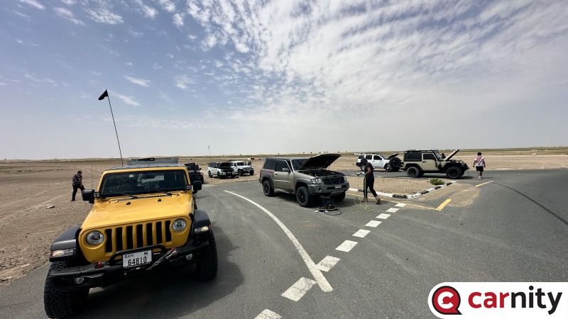
IMG_2956.jpeg
Looper posted a gallery image in Fewbie Plus - Faqa'a Done Right (2nd Edition) - Abu Dhabi - 13 Apr 2024
-
Carnity's Spectacular Off-Road Adventure Videos
Looper replied to Looper's topic in General Discussions
@Aser here you go: -
Thank you all for joining the drive. I am currently travelling and WILL BE BACK tonight. We will use ch 2 for the drive and leave at sharp 7:00 am if not early. Following will be the convoy order.
-
Gary F has been promoted to Support Team
Looper replied to Gaurav's topic in Off-Road Club's Announcements
Congratulations @Gary F. Welcome to the team! -
Carnity's Spectacular Off-Road Adventure Videos
Looper replied to Looper's topic in General Discussions
Premiers at 5:00 pm on 8th April 2024 -
DRIVE PLAN After a wonderful drive we did in February, let's go for one more round in and around Faqa'a. The drive plan is similar to what we did last time, but will last slightly longer time than we did previously. We will meet at a slightly distance place to start to drive, but we save ourselves the hardship of driving though all the bushes. From our favorite playground at Faqa'a we will go towards Little Swihan and end our Drive at Solar Park ~ 10:00 am or so. GENERAL OVERVIEW We request every member that joins this drive to go through the information below and strictly follow these guidelines, etiquette and responsibilities. MUST READ AND COMPLY Environmental Policy Offroad Flag Guideline Two Way Radio Guideline Off road Driving Etiquettes Emergency details for all off roaders Off Road Driving - Roles & Responsibilities DRIVE DETAILS Level: Fewbie Plus and above When: 13 April 2023, Saturdat Meeting time: 6:45 AM - Sharp (we will start the drive at 7:00) Meeting Point: https://maps.app.goo.gl/c7csDnXfSSVzZzgz9 Approximate finish time: 10:00 AM Type of Car: Any proper 4x4 with front and back tow hooks and 8-10 inches of ground clearance. What to bring along: Loads of water, snacks (for yourself), smiles, enthusiasm, and willingness to learn. RECOMENDED OFF-ROAD GEAR: Tire deflator & Tire pressure gauge Compressor (MANDATORY) Walkie-talkie radio (MANDATORY) Off-road flag (MANDATORY) Shovel, Tow Rope & 2 Shackles First-aid kit Fire extinguisher. LIMITED SPOTS AVAILABLE This drive is limited to 10 cars only. If the RSVP is full, you can add your name to the waitlist, once anyone drops, you will be moved to the RSVP list. RSVP will close a day prior to preparing a convoy list. Latecomers will be returned - Without any exceptions. Members without RSVP will be returned - Without any exceptions. Please withdraw your RSVP, if you aren't joining, so your spot can be taken by others. Repeated no-show members after RSVP will have their account suspended for a month. PLEASE RSVP ON THE CALENDAR
-
untilDRIVE DETAILS Level: Fewbie Plus and above When: 13 April 2024, Saturday Meeting time: 6:45 AM - Sharp (We will start the drive at 7:00 so be present earlier to that time) Meeting Point: https://maps.app.goo.gl/c7csDnXfSSVzZzgz9 Approximate finish time: 10:00 AM Type of Car: Any proper 4x4 with front and back tow hooks and 8-10 inches of ground clearance. What to bring along: Loads of water, snacks (for yourself), smiles, enthusiasm, and willingness to learn.
-
20240407_061511.jpg
Looper commented on Luke K P's gallery image in Fewbie - Quick Fix - Qudra - Dubai - 07 Apr 2024
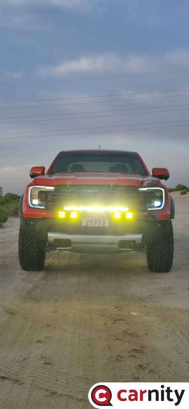 @Luke K P Your off road lights were on while you were on road. I tried calling you but the number seemed to be incorrect