Jump to content

Morning Fewbie Plus Desert Drive - Log Entry 104: The Khatim Anomaly - Abu Dhabi - 19 Oct 2025


_luke_

Recommended Posts

DRIVE DESCRIPTION

LOG ENTRY 104:
Deep within the CARNITY waypoint vaults, I have uncovered fragments of an abandoned dataset — distorted tracks winding through Khatim, their coordinates half-buried in corrupted files and broken telemetry.

The archives were supposed to be complete. They are not. 

Sections have been erased, deliberately — a digital void where the old routes should have been. The more I restore, the stranger it becomes: paths that loop into themselves, waypoints that shift when cross-referenced, and drive reports from past explorers abruptly ending mid-sentence.

It has become clear that I cannot face this alone. I will assemble a small team — veterans of the dunes, mechanics, navigators, and will try recruit an old desert scout who swears he’s seen lights move across Khatim at night, to support us. Each carries their own reason for coming, but perhaps none can quite explain why they feel so compelled to explore this mysterious zone. 

Sunday, we set out at dawn. Our aim: to retrace the ghost routes, to test the limits of what the CARNITY archive conceals. The risks are obvious — terrain instability, magnetic interference, communications dead zones — but the true danger may lie in what waits beyond the last recorded coordinates.

The desert is patient. It watches.

Khatim will not give up its secrets willingly.


MUST READ AND COMPLY

DRIVE DETAILS

Level:  Fewbie PLUS and above

Meeting time: 06:00 (SHARP - Without any exceptions)

Meeting Point:  https://maps.app.goo.gl/SNsWUpYdcx8eCUL56

Type of Car: Any proper 4x4 with front and back tow hooks and 8-10 inches of ground clearance.

What to bring along: Loads of water, snacks (for yourself), smiles, face mask, rubber gloves, enthusiasm and willingness to learn.

Approximate finish time: 10:00

P.S. Only join if you have a compressor to inflate your tires after the drive.

LIMITED SPOTS AVAILABLE

  • This drive is limited to 10 cars only. RSVP will close on SATURDAY - 13:00 PM.
  • If the RSVP is full, you can add your name to the waitlist, once someone drops, you will be moved to the RSVP list.
  • RSVP will close a day prior to preparing a convoy list.
  • Latecomers will be returned back - Without any exceptions.
  • Members without RSVP will be returned back - Without any exceptions.
  • Please withdraw your RSVP, if you aren't joining, so your spot can be taken by others.
  • Repeated no-show members after RSVP will have their account suspended for a month

RSVP HERE BELOW


  • Like (+1) 1
  • Haha (+1) 1
  • Totally Agree (+2) 1
  • Well Done (+2) 6
Link to comment
Share on other sites

UPDATE 20251013: THE EASTWARD DRIFT

An eager team has raised their hands, and pledged their enthusiasm and engines to peering past Khatim’s dark edge. 

I have mapped the existing routes, only to find every historical trail bending directly eastward — an unnatural convergence, as if the desert itself were drawing us away from something.

To the south of these tracks lies a blank — a data void, a digital black hole. None of the recovered coordinates or trails lead into it. The telemetry simply collapses, as though that region refuses to be recorded. One of the CARNITY Support team joked that perhaps the sand there doesn’t cast shadows. No one laughed.

To the region further south of our path — a cluster of domes and steel towers half-buried in the dunes. The old google maps records suggest it was a lunar observation outpost — a facility built for moon sighting, seemingly long abandoned. Rumors claim it still transmits, though I have met none that have received any signal.

The recovered tracks end abruptly near coordinates (24.23625, 54.96446) — my system refuses to render any trails beyond that point. Two waypoints survive in the corrupted map files.

The first, marked in crimson, bears a single name: “NO-GO.”

The second, untitled — its label scrambled into static — glows black on GAIA-GPS. I’ve never seen a black marker before. It isn’t supposed to exist in our waypoint schema.

If the desert meant to warn us, its whisper reached us too late. The course is fixed, and the sands will decide the rest.

  • Like (+1) 3
  • Haha (+1) 3
  • Well Done (+2) 1
Link to comment
Share on other sites

1 hour ago, Luke K P said:

UPDATE 20251013: THE EASTWARD DRIFT

An eager team has raised their hands, and pledged their enthusiasm and engines to peering past Khatim’s dark edge. 

I have mapped the existing routes, only to find every historical trail bending directly eastward — an unnatural convergence, as if the desert itself were drawing us away from something.

To the north of these tracks lies a blank — a data void, a digital black hole. None of the recovered coordinates or trails lead into it. The telemetry simply collapses, as though that region refuses to be recorded. One of the CARNITY Support team joked that perhaps the sand there doesn’t cast shadows. No one laughed.

To the south of our path — a cluster of domes and steel towers half-buried in the dunes. The old google maps records suggest it was a lunar observation outpost — a facility built for moon sighting, seemingly long abandoned. Rumors claim it still transmits, though I have met none that have received any signal.

The recovered tracks end abruptly near coordinates (24.23625, 54.96446) — my system refuses to render any trails beyond that point. Two waypoints survive in the corrupted map files.

The first, marked in crimson, bears a single name: “NO-GO.”

The second, untitled — its label scrambled into static — glows black on GAIA-GPS. I’ve never seen a black marker before. It isn’t supposed to exist in our waypoint schema.

If the desert meant to warn us, its whisper reached us too late. The course is fixed, and the sands will decide the rest.

now i am thrilled to know the rest, i could read a book out of this.... who are you? why the sands draws you? have you been part of the dune movies? :))))

  • Like (+1) 1
  • Haha (+1) 1
Link to comment
Share on other sites

UPDATE 20251014: The Dune Apparition

As part of my pre-reconnaissance, I’ve been analysing the latest satellite overlays of the Khatim Anomaly. The data set is at first glance unremarkable, yet the more I refine the imagery, the stranger it becomes.

For days now, I have studied one particular segment — around coordinates N24° 12' 43.1" E54° 57' 00.1". At first, the dunes appear unremarkable — a natural interplay of wind and time. But under high contrast and multi-band filtering, a pattern emerges from the ridgelines. A symmetry too deliberate to dismiss.

A visage.
Subtle. Vast. Buried in the sand.

The formation resembles the outline of a human face — blurred, eroded, yet undeniably present. It could be an illusion of light and shadow, a trick of erosion… or something older, intentionally carved and reclaimed by the desert. I cannot decide which possibility is more unsettling.

The team has mixed reactions. The CARNITY Support Team refuses to discuss it, saying the dunes are “looking back.” Others insist it’s coincidence — an alignment of ridges and iron-rich deposits. Yet when I cross-referenced historical satellite imagery, the face was not there two years ago.

If the desert is shaping this itself, then it is a process we do not yet understand.
If someone — or something — made it, then we are standing on the edge of a secret meant to stay buried.

The desert keeps changing.
And now, it seems to be watching us.

the anomaly.jpg

  • Like (+1) 1
  • Haha (+1) 2
  • WOW (+2) 3
Link to comment
Share on other sites

UPDATE 20251015: A half remembered dream

Sleep offered no peace last night. I woke before dawn with the image still burning behind my eyes — a twisting structure half buried in the sand, spiralled like a shell yet split open at its peak, as though drawing something down from the sky. I made a quick sketch before it faded, but even the lines on the page feel incomplete, as if the form resists being remembered.

When I compared it to the overlays around Al Khatim Astronomical Observatory, the similarity unsettled me. The dream-structure’s contours echo the twin domes of the facility, but warped, elongated — a reflection seen through heat haze. The coordinates in my dream align too closely with the area east of the observatory, not far from where the face appeared in the dunes. Coincidence would be a comfort, yet the pattern persists.

If the observatory once watched the skies, perhaps now the desert itself is watching back. Could the “face” and this spiral be different aspects of the same phenomenon — one carved into sand, the other revealed in sleep? The more I study, the less distinction I can draw between the maps and my own mind.

I’ve shared none of this with the team.

Until we have physical confirmation, I will file it under Subjective Phenomena — Unverified.
Still, a question lingers:
Are these dreams mine, or are they messages meant for whoever dares to look too long into Khatim?

image.png.709bca083be51bcf5f6e851ff8f32976.png

image.png.c129fa1603051b66e00f33ca746bf151.png

  • Like (+1) 1
  • Haha (+1) 2
  • WOW (+2) 1
  • Well Done (+2) 2
Link to comment
Share on other sites

UPDATE 20251017: 02:00 - THE PERIMETER

Under the cover of darkness, @ChrisW and I set out ahead of the main team to perform a partial reconnaissance along the perimeter of the anomaly. The region in question now shows as a dark shadow region in GAIAGPS labelled as “unmapped.” Among the crew, it’s earned a different name — the Khatim Anomaly.

When arriving for fuel supplies at ADNOC 891, my vehicle was suddenly rendered inert. ChrisW, myself and 2 mechanics worked on it to discover the battery had been mysteriously drained beyond a recoverable limit requiring replacement.

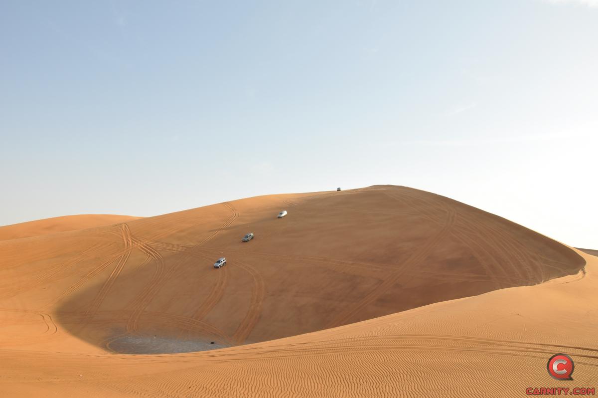
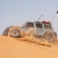
Once regaining power, We stayed on the outer ridgelines, keeping distance from the boundaries. The terrain is enticing, low vegetation, large long range dunes, but deceptively calm — long soft gradients of wind-shaped sand, not a single tyre mark, no camel prints, not even the remnants of a trail. 

The dunes feel… untouched, as if nothing has crossed them in years. Perhaps ever.

Yet the paths leading toward the anomalous zone remain perfectly accessible — firm ground, navigable slopes, no apparent danger. And still, something in the air made us hesitate. The silence was too complete. Even the wind seemed to hold its breath.

From the Eastern most point we could see faint distortions further to the south east, like heat shimmer without the heat — a wavering of space itself. @ChrisW refused to share the GPX track we had taken; said his instruments were giving false returns.

I marked what I could of the edge of the zone, and withdrew. No signs of movement. No sound.

Just the quiet weight of the unknown, waiting. Sunday I will bring the rest of the team closer. To map the "un-mappable".

Caution will be our only ally.


1760650563795.jpg

IMG-20251016-WA0014.jpg

  • Like (+1) 2
  • Haha (+1) 1
  • Well Done (+2) 2
Link to comment
Share on other sites


×
×
  • Create New...

Important Information

Terms of use