
Leaderboard


Popular Content
Showing content with the highest reputation on 02/17/2022 in all areas
-
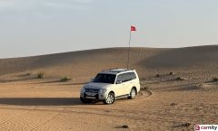
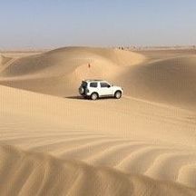
@Mario Cornejo @Amir Amiri @Ranjan Das @Mus_hus78 @Jorge Stepniak Felippe @Xavier Treasurer @varunmehndiratta Thank you for signing up for what hopefully would be a wonderful journey. So what do we expect on this adventure : For starters, expect to see some of the biggest sand dunes that one can witness in the UAE. Liwa is known for super soft sand even in winters. Driving at the right tyre pressure is going to be extremely critical for this drive, so please keep checking your tire pressure at every break that we do take. Everyone at the IM level is expected to bring in their full set of recovery gears, There would be some dunes that would be difficult for me to come back so you would be required to recover the cars that is a position in front or behind of yourself. I have planned the route based on a track provided by the AD Tourism department. However since this is the IM convoy we will be going a bit off the exact course to witness some of the huge dunes and bowls that this area has to offer. Depending on the fluidity of the convoy, we would be mixing up the the amount of dunes and sabkha. Hopefully, if everything goes well we ought to have covered approx 70- 80% of the course on the first day with the remaining part for Sunday. I would be assigning the convoy numbering on the day of the drive. See you guys in Liwa !! Thanks for informing Alexander. Hope to meet you the next time.6 points
-
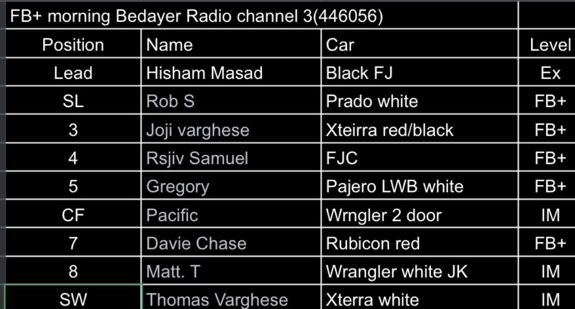
Dear desert lovers @Rob S @Joji varghese @Rsjiv Samuel @Gregory @Pacific @Davie Chase @Matt.T and @Thomas Varghese, looking forward to enjoy the weather and sand tomorrow in the following order. Hoping will have a good time. For any emergency please contact me on 0506318834.
 5 points
 -
Thanks @Islam Soliman & @Vanessa8580 for adding me to this drive. Looking forward to see you on Sunday.4 points
-
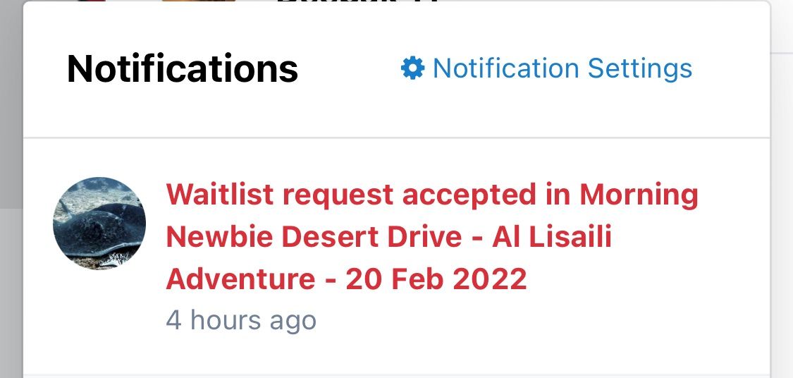
Screenshot of One of my fav Notifications attached😁😁🤩🤩! Thank you @Islam Soliman & @Vanessa8580!!! Super excited!! 🥳🥳 (And @Hisham Masaad! Just noticed you too on this ! looking forwars😁)
 4 points
 -
Congratulations @Michel Van Woudenberg well deserved my friend.4 points
-
Bravo for the person who brought his brand new LC 300 GR Sport just one day after taking the delivery... @Michel Van Woudenberg 👏👏👏3 points
-
Thanks Simon !!3 points
-
I didn't get it...paid AED1462 points
-
FYI Gaia is currently having a 40% off promotion of its Premium Membership 💪2 points
-
As @Vanessa8580 says, I will lead a drive on Saturday morning. Looking forward to this, as I have been out of Carnity action for a few weeks. @Juzer Gandhi hope to live up to expectations.2 points
-
After reading your bare essentials I think I will wear my shorts 🩳 instead of jeans 👖 as that will reduce some grams off my 3.8 pajero 😎…..just kidding will take what is required by my car ….. thinking of the drive my tummy is rumbling 😅2 points
-
Hi everyone I increased the RSVP and we are going to split into 2 convoys for this drive. I am going to lead one and @Wrangeld is going to lead the other one.2 points
-
Hi everyone.. good news! thanks to @Vanessa8580 volunteering to lead a second convoy we are able to double the RSVP and extend it to accommodate a big part of the WL. So pls check the RSVP now and let us know if you have any changes in ur plan so we can take up others from the WL.. thanks @Vanessa8580 ea all2 points
-
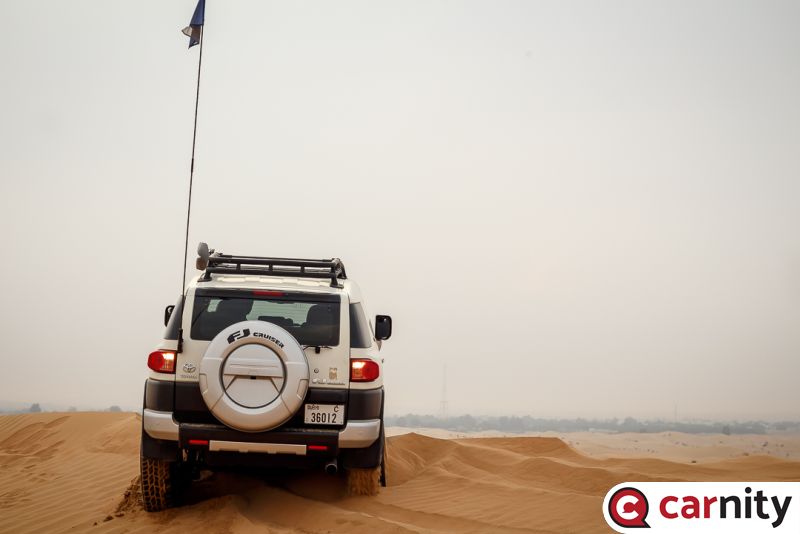
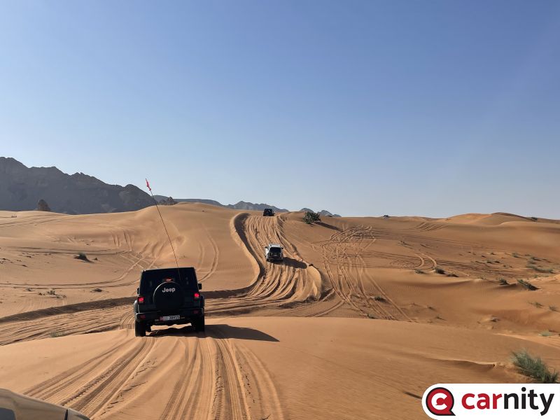
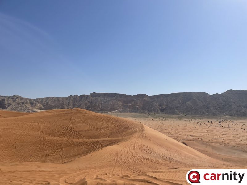
A bit late in the day for my thoughts on the drive but, nevertheless. It was my second newbie drive with @Islam Soliman but first one driving myself. As usual we started with an elaborate briefing by the lead and wonderful weather to drive that day. Margham area presents a unique landscape where one hone their off-road skills and boy we did practice a lot. While off-roading you not only get to know your car, but the car gets to know you. It's not just poetic to say so - because it is a fact. You learn to what extent you can push it and how to push it. You know how it behaves in certain situations and manages it. Similarly, your car learns from you what you expect and gradually both the car and the driver become one. There were some refusals along the way, but they were good refusals in my opinion. Better to get stuck while going slow to cross a dune than to go fast and fly off the other side. Because it is safer to gradually increase the speed than to be at high speed and get into trouble and then try to reduce it. First of all, a big thanks to @Islam Soliman for a great fun drive. @Suresh K you did well as the second lead and @Sharat Nambiar as the sweep. It was great to drive with you @Haitham Khattab, @Serhat Yalcinkaya, @Krishna R, @Mahmoud Taha, @karim hamandi, @Awais Zuberi and @Yesu Yarlagadda (also congratulations are in order on your promotion). See you all soon in another drive.2 points
-
Congratulations @Michel Van Woudenberg and Well Done 👍2 points
-
Hey @Imteeaz! Sorry we havent crossed path for a while bro, looks like you are overdue for a promotion, pls put it in so we can drive together again as fewbie+ !2 points
-
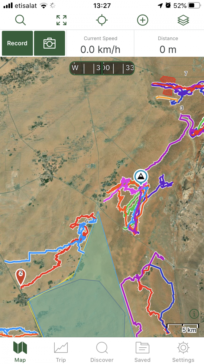
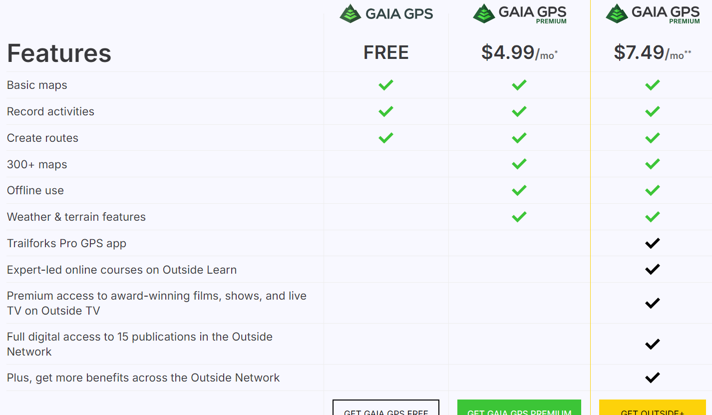
For many offroaders, navigation looks like a scary thing, and finding your way in the desert used to be a daunting task with old obsolete maps, navigation with sun or stars, and many other old tricks of crossing the deserts. Until 5-6 years ago, companies like TomTom and Garmin were ruling the world navigation software and hardware, until our phones became smarter and smarter, and nowadays there are tons of free or paid navigation software programs available which are tailored for hiking, off-roading, cycling, or other outdoor activities where you would like to record your tracks. In this post i will give some basic essential advice on how to get started with navigating by using GaiaGPS, which is an amazing app that allows you to: 1) Create routes at home via your desktop/tablet through the GaiaGPS website. 2) Use different types of maps like topographic maps, sattelite maps, to find your perfect route you'd like to explore. 3) Save and manage all your tracks, waypoints, areas. 4) Automatically sync all this data with the GaiaGPS Mobile App that is being used to record your track or follow the route you have created beforehand. 1) Registering for GaiaGPS account https://www.gaiagps.com/membership/ You can choose for a FREE account, which works fine for basic topographic and satellite maps, but will not allow to use them offline. The PREMIUM membership is recommended for around 60USD per year. The Outside+ subscription is useless as this is mostly for US based customers. Their Trailforks Pro App is very similar to Wikiloc. Once you have become a member, you can head over to Gaiagps.com, login with your account name, and have a look at the basic functionalities. I've posted a short video below that gives a small demo on how to use the GaiaGPS website functionalities. As you can see in the screen, there are many tracks i've recorded with my phone that remain saved in the website. You can remove these or hide them. The red zones i have marked are called "areas" where you can identify tricky areas that you would like to avoid. They will appear on your phone app as well so you can easily avoid them. Waypoints Waypoint, or pins, could be points of interest, landmarks, entry and exit points, or any place where you want to mark the location and save for later reference. They will appear as a "pin" on your map. You can assign a color to them as you like. This might be useful as you can categorize them. Next to the classic PIN icon, you can choose different other ones, like fences, skulls, forest, or anything that will help you in identifying the waypoint. Satellite Images Having crisp detail in the satellite images you are looking, is essential so you can create a route which focuses on the nice bigger dunes instead of the small technical or bushy areas. Gaia comes standard with the Mapbox "Sattelite with Labels" Imagery which is not bad, but the best one i have found so far is the ESRI Sattelite Imagery Map. Below you will find some information on how to add custom maps. The map called "WORLD IMAGERY" in the Premium version is the same as the ESRI Sattelite Imagery Map. Which phone ? Gaia GPS will work on any smartphone that has a decent GPS antenna built-in. In my case i purchased a separate dedicated Android phone which is mounted in my car that i solely use for navigation. This allows me to keep using my own phone as backup device. That dedicated phone has the offline maps downloaded on it, so i don't need cellphone coverage (no sim card). App functionality On an Iphone, this is how the app looks like. The buttons like "RECORD" and "PICTURE" are customizable, and by keeping your finger on it you can select something else you would like to see on the home page. The Magnifying Glass allows you to enter coordinates. You can copy them from within Google Maps. this button toggles between full screen or normal screen. The crosshair button is very important. Click on it once and it will appear green and bring you to your live location and follow you while keeping NORTH up. Click on it again and another logo appears, looking like two reversed triangles. This is the mode that keeps your live location but constantly rotates the map based on your direction. You can experiment with both modes to see what suits you best. I like to stick to the first mode because it allows me to see in which compass direction i am heading. The + Button contains all your other useful functionalities, like adding a waypoint, creating a route, download an offline map, or create an area. Once you hit the record button, the app will start recording your track. Once you finish, click again on it and select "Finish Track" It will then be saved. (and also appear on your GaiaGPS website once you have synced). On the bottom, you can see your trip details, open the list of saved tracks, or go to your settings. Note: In the settings you can put your units/distances in miles or kilometers (whatever you prefer). You can also enable or disable the autosync function, but better to keep it on. So as soon as you have Wifi/Internet on your phone it will automatically sync your tracks between the app and your GaiaGPS account (website). These things will take a bit of practice, and i can recommend you use your Gaia mobile app for a while on your daily commute and experiment a bit with the settings until you have tailored it to your own needs. Exporting Maps Most navigation software use .gpx or .kml files which you can import in Google Earth / Maps or any other navigation program. On the GaiaGPS website, and also on the app you can choose to "export" your track. It will create a .GPX file that you can share with fellow offroaders or import in the Relive app Adding Custom Maps Adding a TMS Map Source – Gaia GPS for the GaiaGps app users, the Google Maps like Satellite, Terrain, or Hybrid, are not standard built in, but can easily be added by using the GaiaGps website. This is the procedure to add for example Google Terrain. 1) While logged into Gaiagps.com, add a custom map source via TMS here: https://www.gaiagps.com/mapsource/add/ 2) Fill in this TMS URL to get Google Terrain: https://mt0.google.com/vt/lyrs=p&hl=en&x={x}&y={y}&z={z}&s=Ga 3) Give it the name "Google Terrain" 4) Set the Min and Max Zoom level on 4 and 19. 5) Click on "Add this Map Source" The next time you will login it will appear in your mobile app. Some other map links. To add them, follow the same steps as above: Google Maps: https://mt1.google.com/vt/lyrs=r&x={x}&y={y}&z={z} Google Satellite:https://www.google.cn/maps/vt?lyrs=s@189&gl=cn&x={x}&y={y}&z={z} Google Satellite Hybrid:https://mt1.google.com/vt/lyrs=y&x={x}&y={y}&z={z} Google Terrain:https://mt1.google.com/vt/lyrs=t&x={x}&y={y}&z={z} Google Roads:https://mt1.google.com/vt/lyrs=h&x={x}&y={y}&z={z} ESRI Sattelite Imagery:https://server.arcgisonline.com/ArcGIS/rest/services/World_Imagery/MapServer/tile/{z}/{y}/{x} Open Topo Maps: https://a.tile.opentopomap.org/{Z}/{X}/{Y}.png Others can be found here: Folder: / (arcgisonline.com) 15 Free Satellite Imagery Data Sources - GIS Geography


 1 point
 -
Dear Islam, I have completed 1on1 MC with Anish. He advised that I sign up directly to newbie. I hope it’s ok. Many thanks. Kind regards. Andrei1 point
-
Hi @Andrei S, there is no record of you completing an Abdolute Newbie drive with Carnity. So unless you have done an MC I will have to ask you sign out and join an absolute Newbie drive first as it’s a prerequisite for NB drives .. pls let me know as soon as possible tonight .. thx1 point
-
Your maximum validity for PCR is only 14 days so I think you’ll need to get a test done1 point
-
The views for this drive are higher than average. Very happy to be part of the group1 point
-
Hi dear srikumar, please tell me do we need PCR test?1 point
-
@Daniel Yang Congratulations!!!1 point
-
1 point
-
Hi @Vanessa8580, @Wrangeld, Was looking forward to this exciting drive this weekend.. however, will have to pull out for now,.. Wish you all a great drive!1 point
-
Hi @Islam Soliman . I am really looking forward to this. I heard Al Lisaili has great dunes.1 point
-
Nice job and congrats @MMansoor 👍1 point
-
Congratulations @Michel Van Woudenberg1 point
-
Congratulations @MMansoor1 point
-
Congrats @MMansoor1 point
-
Congratulations @MMansoor1 point
-
Well Done @MMansoor, congratulations1 point
-
Hii @Chaitanya D Am going on one with Vanessa on 19th...but would love to join this as night drive would be amazing experience too:) and considering the fact just after full mooon:)🙌🏼1 point
-
Congrats @MMansoor well deserved, hope to see you there next week1 point
-
1 point
-
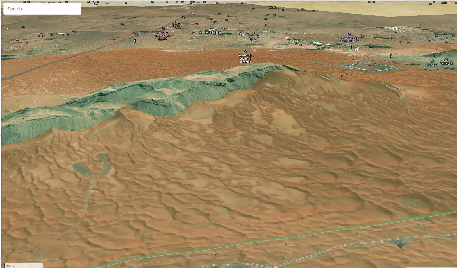
Gaia maps is now 3D. its pretty impressive how detail it is specially in mountainous areas. Im sure everyone who has subscribed might have got the email. if you did not receive it here the link. https://blog.gaiagps.com/worldwide-3d-maps-gaia-gps/?utm_source=newsletter&utm_medium=email&utm_campaign=February-newsletter-4-nonsubscriber @Frederic waiting for your review on this 😀 one our favourite fossil rock looks like this.
 1 point
 -
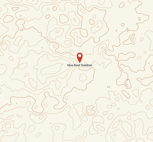
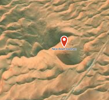
Difference between Topo map and Sattelite Image:
 1 point















This leaderboard is set to Dubai/GMT+04:00