Leaderboard
.thumb.jpg.faf264f698ded093f59df7be5597f9ce.jpg)

Popular Content
Showing content with the highest reputation on 02/02/2024 in all areas
-
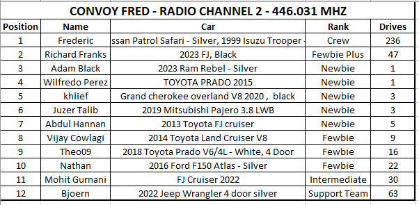
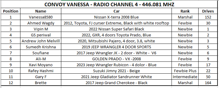
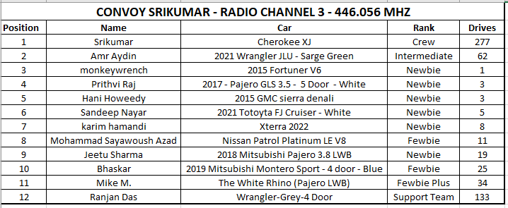
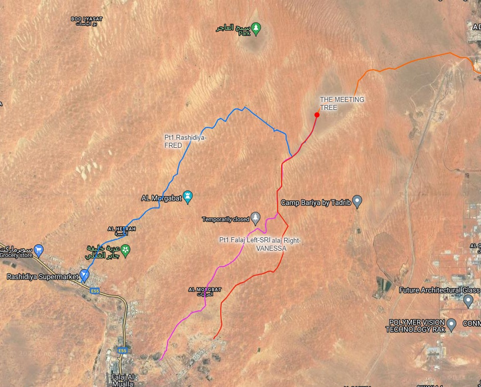
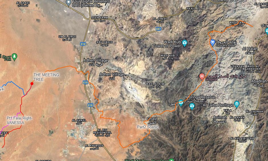
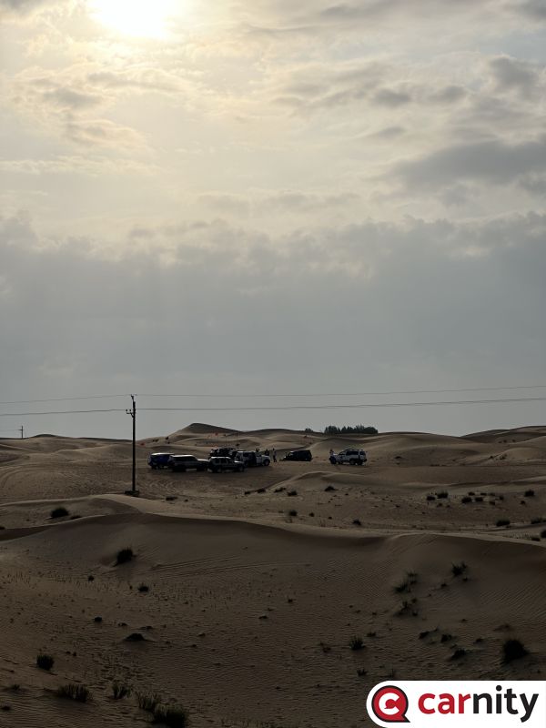
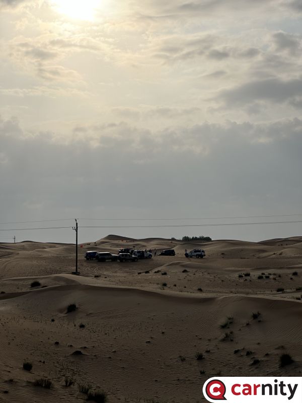
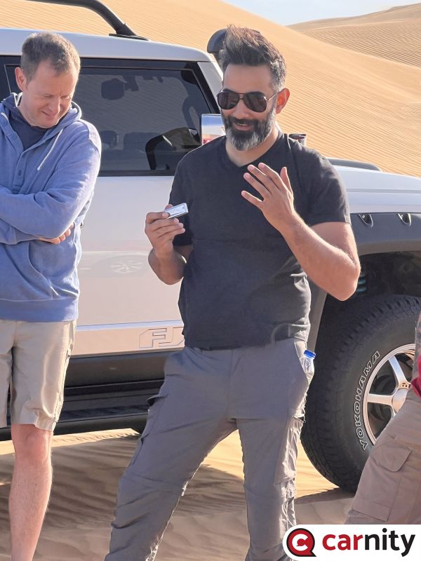
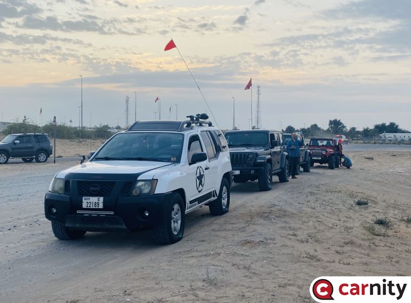
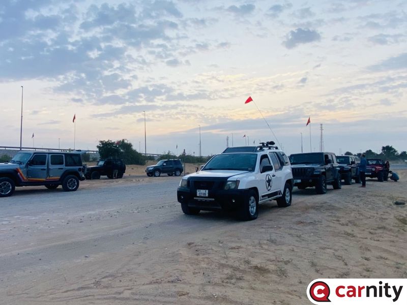
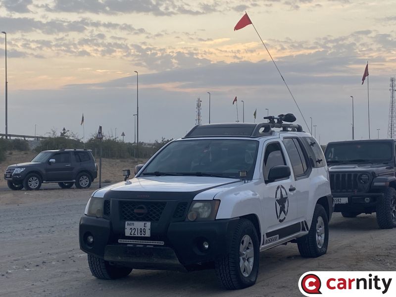
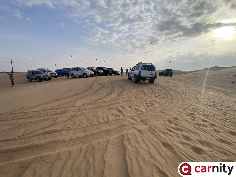
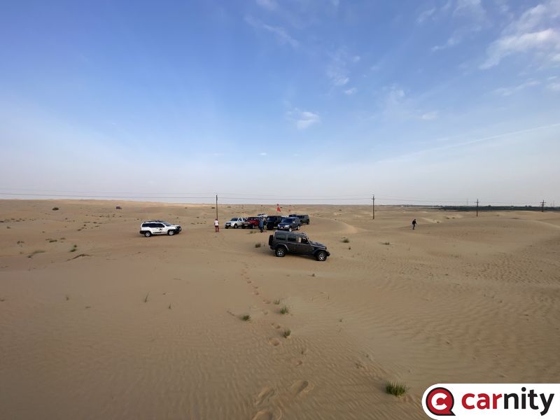
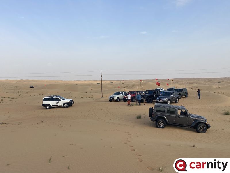
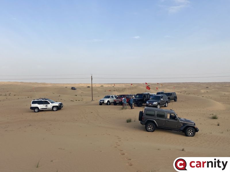
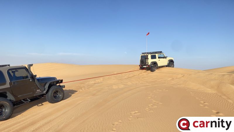
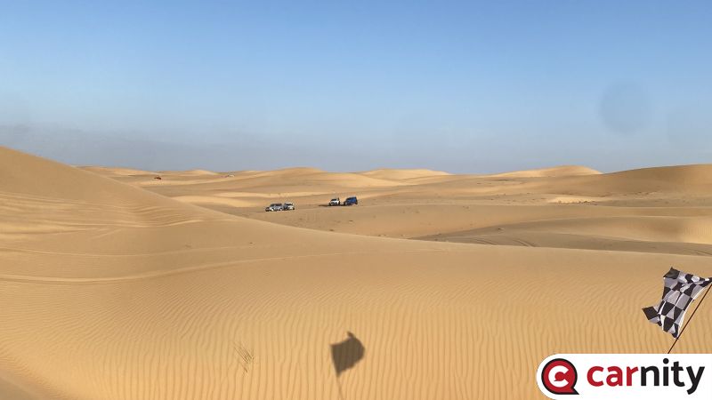
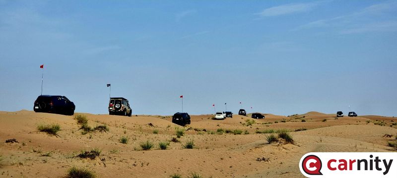
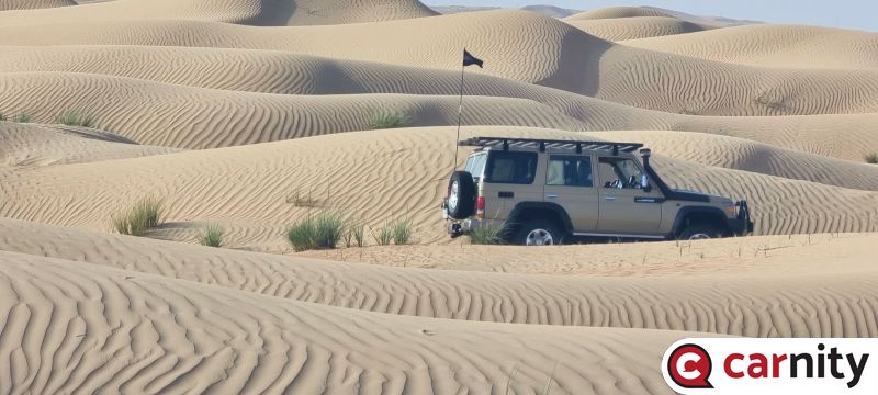
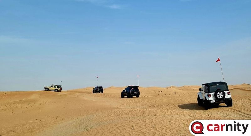
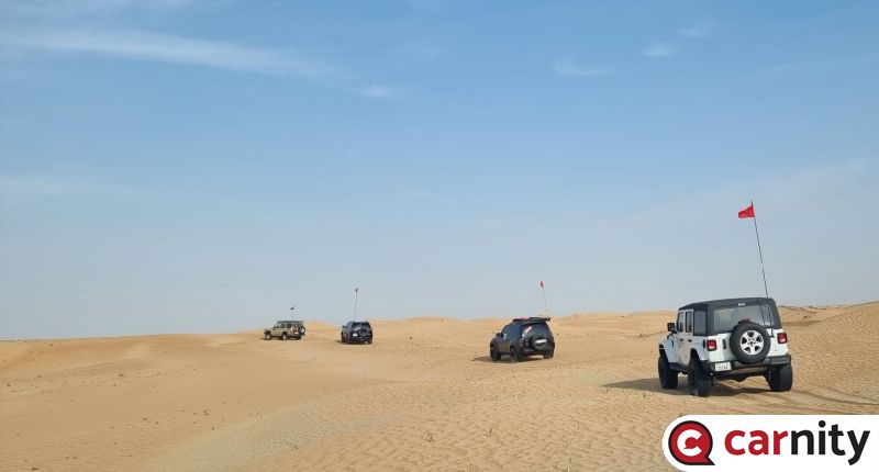
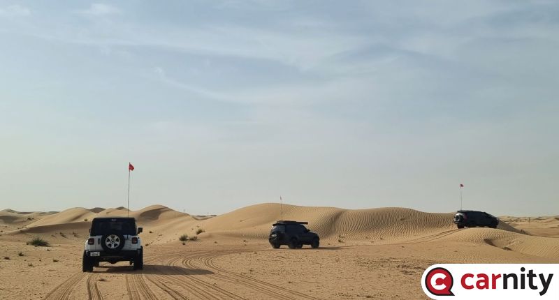
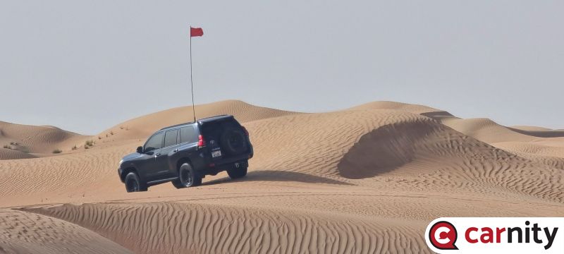
@Richard Franks@Adam Black@Wilfredo Perez@khlief@Juzer Talib@Abdul Hannan@Vijay Cowlagi@Theo09@Nathan@Mohit Gurnani@Bjoern Meeting Point: Rashidiya: https://maps.app.goo.gl/9qKoAHpzkG4R3PCw5 When you arrive, there is no need for putting a flag. Please do deflate to around 20psi, it's not needed to go much lower than that. See you all Sunday morning ! ------------------------------------------------------------------------------------------------------------------------------------------- @Ahmed Wagdy@Vipin M@GS periwal @Andrew John Melvill@Sumedh Krishna@Soufiane@Ali-M@Xavi Moyano@Rafey Hashmi@Gary F@Brette Meeting Point: -Falaj Al Mualla Spot2 : https://maps.app.goo.gl/EKYWdof4BYNDwRXE8 When you arrive, there is no need for putting a flag. Please do deflate to around 20psi, it's not needed to go much lower than that. See you all Sunday morning ! --------------------------------------------------------------------------------------------------------------------------------------- @Amr Aydin@monkeywrench@Prithvi Raj@Hani Howeedy@Sandeep Nayar@karim hamandi@Mohammad Sayawoush Azad@Jeetu Sharma@Bhaskar@Mike M.@Ranjan Das Meeting Point: Falaj Al Mualla Spot1: https://maps.app.goo.gl/gngmhHmXvVsjd95U6 When you arrive, there is no need for putting a flag. Please do deflate to around 20psi, it's not needed to go much lower than that. See you all Sunday morning ! ----------------------------------------------------------------------------------------------------------------------------------------- DRIVE PLAN FOR ALL CONVOYS We have put 3 different meeting points so we can park and accommodate this amount of cars safely. The three tracks will run basically parallel (a few kms apart) from each other and the plan is to meet up with all three convoys at a nice tree on a huge sabkha in RAK. It will take around 1 hour to get there. After taking some nice photos with the three convoys, each convoy will move towards part 2 of the trip where we will head out into the mountains and small village roads. The exit point is also at the same spot. Below you can see Part 1 (up to the sabkha), and Part 2 of our adventure for Sunday.
 9 points
 -
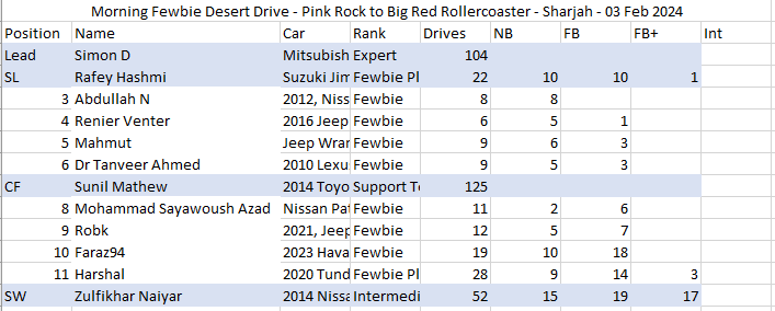
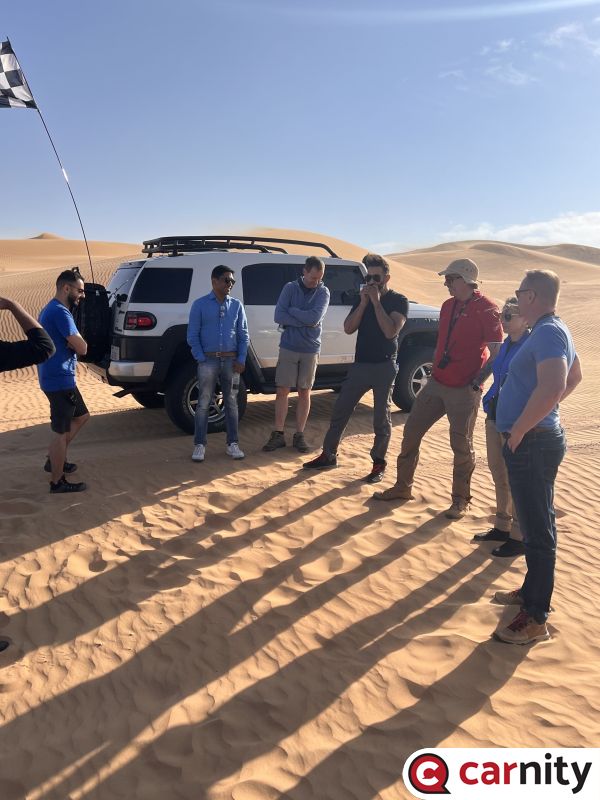
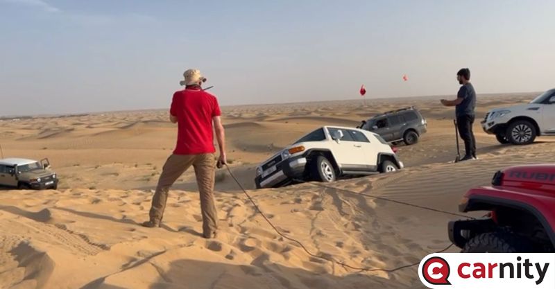
Dear Challenge seeker, I hope you are excited for our tomorrow's drive. Due to the rain rain showers the past few hours , i will kindly ask you to be extra focused on the drive and keep a very good control of our vehicles avoiding even the slightest fishtailing!! as the sand could be unexpected . always emphasized and required that everyone make sure of your car is in a perfect shape and have all your gear as per your rank. Meeting Point: https://maps.app.goo.gl/8h8yf4zznDE4jQbJ6 Meeting time is 07:00 AM Sharp We will use Carnity Radio Channel 7. The convoy order will be as the following :
 5 points
 -
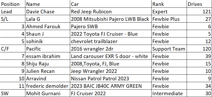
Dear Desert Wanderers, @frederic demolder, @sohinik, @essam ibrahim, @Ahmed Farouk, @Shiju Raju, @Lala G, @Julien Recan, @Arravind, @Shaun J, @Mohit Gurnani and @Pacificwe will be meeting at Lisalli, flags up & ready for briefing at 1300 tomorrow. The convoy order will be as per the below and we will be using Ch4 (446.081). Please bring plenty of enthusiasm with you and that all important willingness to learn See you tomorrow Afternoon
 4 points
 -
Thanks @Frederic, google is weird sometimes when you just look for "gas stations" in the area... I'll try this one then. @Ale Vallecchi, I'll get a small jerry can with me just in case. Better safe than sorry.3 points
-
@Abdul Hannan @Sviatoslav @monkeywrench @Wilfredo Perez @Juzer Talib @Tatsiana Chase @Damian @Hani Howeedy @ozgu @SamBha @Mehmet Volga Dear Desert Drivers, Thank you for signing up for the drive tomorrow morning. The weather is a bit uncertain, but nothing to prevent driving. So the drive will happen anyway, we will adjust if needed if we find wet places. If you are delayed on the road to the meeting point by the weather conditions (fog, rain...) don't worry and drive safely, we will wait for you. Please check your route to reach the meeting point. Coming from Nahel, about 300m before the final location, you will see a road to your right, with a sign "...Winter Camp..." Take that road. It is closed by a fence. Reach slowly by the fence, it will open by itself. Then continue until you see the other cars. I will indicate the convoy order and the radio channel by the end of the afternoon.
 3 points
 -
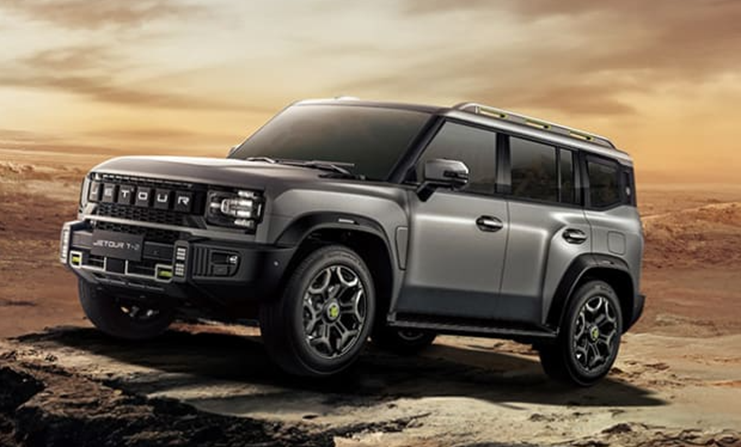
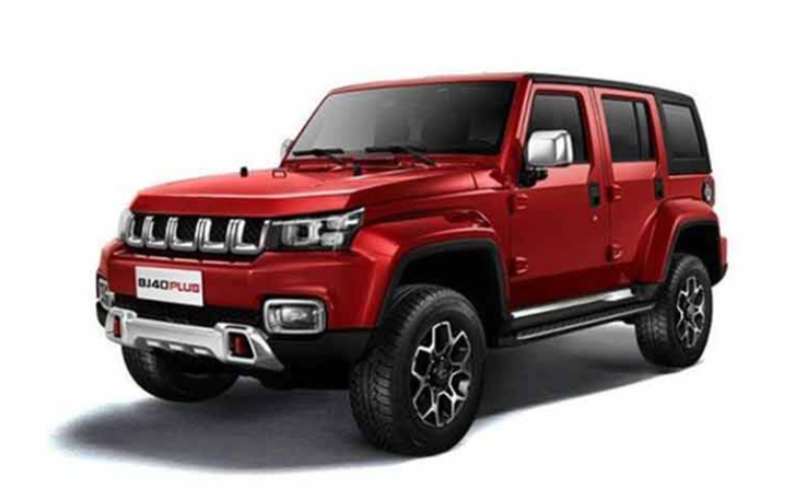
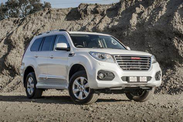
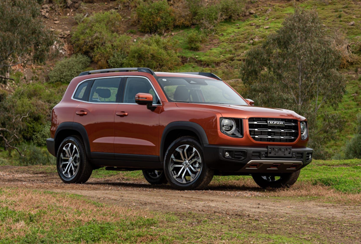
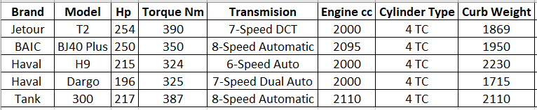
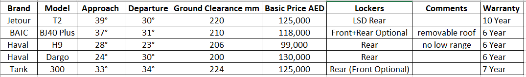
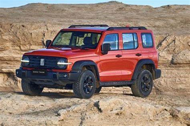
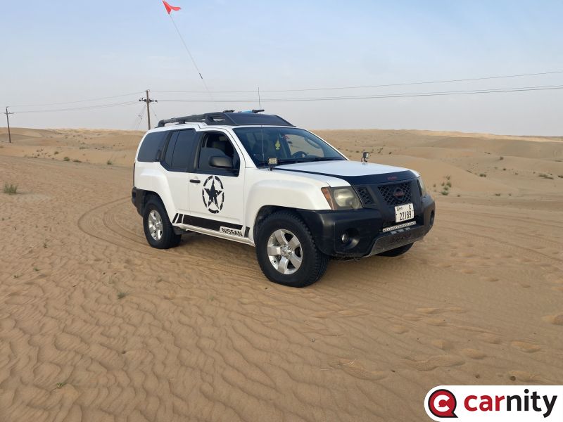
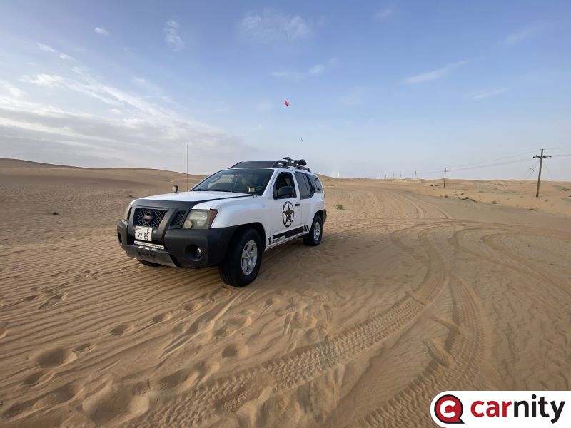
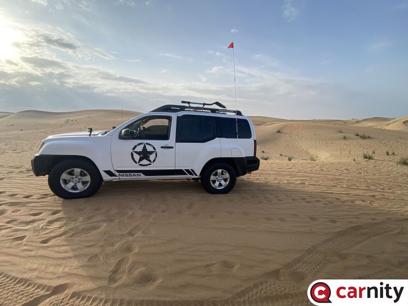
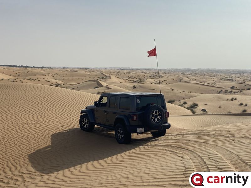
There used to be a time where Chinese 4x4's were rare in the UAE, and the overall consensus amongst the public would be to avoid them, or walk around them with some curiosity, not really being sure as what to expect and how these would perform in the UAE deserts. Over the last couple of years, we have seen the introduction of several 4x4's in the UAE coming from the Far East, often with a big marketing campaign and lots of bang for the buck. Often accompanied by very interesting warranty and service deals. In below topic, the aim is to compare the most recent models and discuss their potential performance and pricing. We will focus mostly on the 4x4 capabilities, and not so much on the comfort creatures or technology. To value these vehicles on their performance in the desert is not easy. But by looking at their specs in terms of power, ground clearance, and approach/departure angles, we can have a fairly good impression on what to expect from them. Of course, the real answer will only come after a couple of years to see if they really can rival with the Japanese reliability or the Jeep versatility and power. For now, let's have a look at below selection of 5 4x4's we compared: Jetour T2 BAIC BJ40 Plus Haval H9 Haval Dargo Tank 300 @frederic demolderand @Faraz94 are proud owners of BAIC and Haval 4x4's, and drive regularly with us. Would love to hear their comments and experiences, and invite everyone to chip in with their feedback and opinions !
 2 points
 -
Very True. You can add Google Satellite maps to GaiaGps by adding as a custom map.2 points
-
Hi @Marek_was003. Thanks for bringing it up, and thanks to @Frederic for providing the location of the closer gas station. The one time I did that track, I managed with one full tank (78 lts) all the way from that gas station and back halfway between AD and Dubai on E11. Plus the last part of the drive will be on a dirt track, all streight and easy to manage. I think you can do it. Please let me know what you decide. Thanks a lot.2 points
-
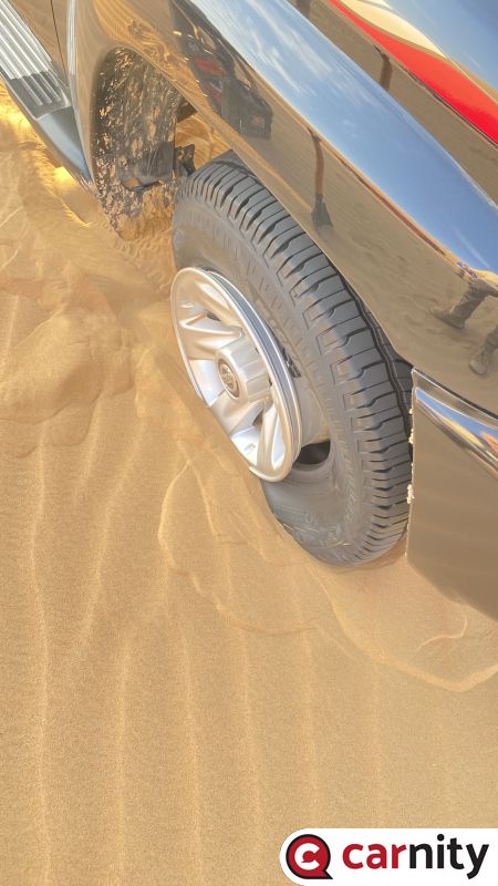
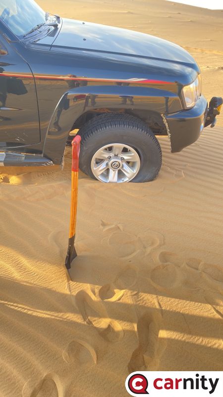
since I replaced stock rims and tyres with FJ cruiser 2022 big tyres - 265/70/17 they won't fit my rear cover...technician tried many ways but wouldn't fit....Marek's option looks much better with compressor fitted but I would prefer Stumpy's way....btw I also contacted the Australian guy who made this originally... Joseph Jenson...he says 890aed...I think it is expensive....looking for someone to fabricate this locally in UAE...will keep you posted...thanks for your suggestions guys... :)2 points
-
2 points
-
2 points
-
2 points
-
2 points
-
2 points
-
2 points
-
2 points
-
2 points
-
2 points
-
2 points
-
2 points
-
2 points
-
2 points
-
2 points
-
2 points
-
2 points
-
2 points
-
2 points
-
2 points
-
2 points
-
2 points
-
2 points
-
2 points
-
2 points
-
2 points
-
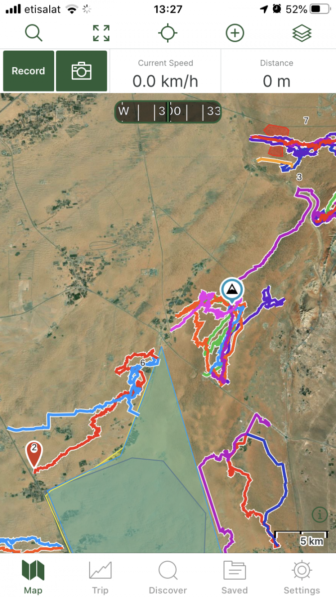
For many offroaders, navigation looks like a scary thing, and finding your way in the desert used to be a daunting task with old obsolete maps, navigation with sun or stars, and many other old tricks of crossing the deserts. Until 5-6 years ago, companies like TomTom and Garmin were ruling the navigation software and hardware, until our phones became smarter and smarter, and nowadays there are tons of free or paid navigation software programs available which are tailored for hiking, offroading, cycling, or other outdoor activities where you would like to record your tracks. In this post i will give some basic essential advice on how to get started with navigating by using GaiaGPS, which is an amazing app that allows you to: 1) Create routes at home via your desktop/tablet through the GaiaGPS website. 2) Use different types of maps like topographic maps, sattelite maps, to find your perfect route you'd like to explore. 3) Save and manage all your tracks, waypoints, areas. 4) Automatically sync all this data with the GaiaGPS Mobile App that is being used to record your track or follow the route you have created beforehand. 1) Registering for GaiaGPS account https://www.gaiagps.com/membership/ You can choose for a FREE account, which works fine for basic topographic and sattelite maps, but will not allow to use them offline. The PREMIUM membership is recommended for around 3.3 USD per month. Once you have become a member, you can head over to Gaiagps.com, login with your account name, and have a look at the basic functionalities. I've posted a short video below that gives a small demo on how to use the GaiaGPS website functionalities. As you can see in the screen, there are many tracks i've recorded with my phone that remain saved in the website. You can remove these, or hide them. The red zones i have marked are called "areas" where you can identify tricky areas that you would like to avoid. They will appear on your phone app as well so you can easily avoid them. Waypoints Waypoint, or pins, could be points of interest, landmarks, entry and exit points, or any place where you want to mark the location and save for later reference. They will appear as a "pin" on your map. You can assign a color to them as you like. This might be useful as you can categorize them. Next to the classic PIN icon, you can choose different other ones, like fences, skulls, forest, or anything that will help you in identifying the waypoint. Sattelite Images Having crisp detail in the sattelite images you are looking, is essential so you can create a route which focuses on the nice bigger dunes instead of the small technical or bushy areas. Gaia comes standard with the Mapbox "Sattelite with Labels" Imagery which is not bad, but the best one i have found so far is the ESRI Sattelite Imagery Map. Below you will find some information on how to add custom maps. The map called "WORLD IMAGERY" in the Premium version is the same as the ESRI Sattelite Imagery Map. Which phone ? Gaia GPS will work on any smartphone that has a decent GPS antenna built-in. In my case i purchased a separate dedicated Android phone which is mounted in my car that i solely use for navigation. This allows me to keep using my own phone as backup device. That dedicated phone has the offline maps downloaded on it, so i do not need cellphone coverage (no sim card). App functionality On an Iphone, this is how the app looks like. The buttons like "RECORD" and "PICTURE" are customizable, and by keeping your finger on it you can select something else you would like to see on the home page. The Magnifying Glass allows you to enter coordinates. You can copy them from within Google Maps. this button toggles between full screen or normal screen. The crosshair button is very important. Click on it once and it will appear green and bring you to your live location and follow you while keeping NORTH up. Click on it again and another logo appears, looking like two reversed triangles. This is the mode that keeps your live location but constantly rotates the map based on your direction. You can experiment with both modes to see what suits you best. I like to stick to the first mode because it allows me to see in which compass direction i am heading. The + Button contains all your other useful functionalities, like adding a waypoint, creating a route, download an offline map, or create an area. Once you hit the record button, the app will start recording your track. Once you finish, click again on it and select "Finish Track" It will then be saved. (and also appear on your GaiaGPS website once you have synced). On the bottom, you can see your trip details, open the list of saved tracks, or go to your settings. Note: In the settings you can put your units/distances in miles or kilometers (whatever you prefer). You can also enable or disable the autosync function, but better to keep it on. So as soon as you have Wifi/Internet on your phone it will automatically sync your tracks between the app and your GaiaGPS account (website). These things will take a bit of practice, and i can recommend you to use your Gaia mobile app for a while on your daily commute, and experiment a bit with the settings until you have tailored it to your own needs. Exporting Maps Most navigation software use .gpx or .kml files which you can import in Google Earth / Maps or any other navigation program. On the GaiaGPS website, and also on the app you can choose to "export" your track. It will create a .GPX file that you can share with fellow offroaders or import in the Relive app Adding Custom Maps for the GaiaGps app users, the Google Maps like Satellite, Terrain, or Hybrid, are not standard built in, but can easily be added by using the GaiaGps website. This is the procedure to add for example Google Terrain. 1) While logged into Gaiagps.com, add a custom map source via TMS here: https://www.gaiagps.com/mapsource/add/ 2) Fill in this TMS URL to get Google Terrain: https://mt0.google.com/vt/lyrs=p&hl=en&x={x}&y={y}&z={z}&s=Ga 3) Give it the name "Google Terrain" 4) Set the Min and Max Zoom level on 4 and 19. 5) Click on "Add this Map Source" The next time you will login it will appear in your mobile app. Some other map links. To add them, follow the same steps as above: Google Maps: https://mt1.google.com/vt/lyrs=r&x={x}&y={y}&z={z} Google Satellite:https://www.google.cn/maps/vt?lyrs=s@189&gl=cn&x={x}&y={y}&z={z} Google Satellite Hybrid:https://mt1.google.com/vt/lyrs=y&x={x}&y={y}&z={z} Google Terrain:https://mt1.google.com/vt/lyrs=t&x={x}&y={y}&z={z} Google Roads:https://mt1.google.com/vt/lyrs=h&x={x}&y={y}&z={z} ESRI Sattelite Imagery:https://server.arcgisonline.com/ArcGIS/rest/services/World_Imagery/MapServer/tile/{z}/{y}/{x}


 1 point
 -
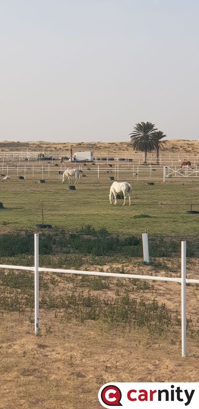
Both will love it. The first part can be a little bit bumpy as we are driving on a farm track, but the second part is tarmac and gravel.1 point
-
1 point
-
1 point
-
1 point
-
1 point
-
1 point
-
1 point
-
1 point
-
1 point
-
1 point
-
1 point
-
1 point
-
1 point
-
1 point
-
1 point


This leaderboard is set to Dubai/GMT+04:00